Lakewood Park night lights from space
Night Light of Lakewood Park (Florida) from space (United States) Src. Average luminocity for 10x10km area is 45.002% and for 50x50km: 18.9305%.
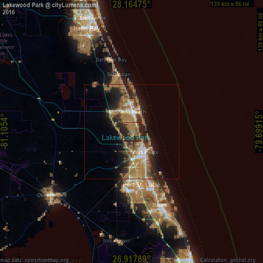
Analysis of Lakewood Park night lights 2016
Square area 10x10 km:
 0.2%
0.2%90-99
1.39%80-89
2.58%70-79
6.94%60-69
23.21%50-59
9.92%40-49
8.93%30-39
8.93%20-29
31.75%10-19
6.15%0-9
0%Square area 50x50 km:
1.65%90-99
2.13%80-89
1.13%70-79
1.98%60-69
7.98%50-59
3.7%40-49
3.11%30-39
3.16%20-29
5.9%10-19
7.74%0-9
61.51%Clear (daylight) street map image can be seen on geolist.org.
Map coordinates:
28° 9' 53.1" North, 81° 6' 19.4" West
27° 32' 35.1" North, 80° 24' 8.2" West
26° 55' 4.4" North, 79° 41' 56.9" West
Some cities around Lakewood Park sort by population:
• Fort Pierce
13.1 km =8.1 mi,  144°
144°
• Vero Beach South
8.2 km =5.1 mi,  352°
352°
• Florida Ridge
4.4 km =2.7 mi,  20°
20°
• Vero Beach
10.6 km =6.6 mi,  2°
2°
• Gifford
14.7 km =9.1 mi,  357°
357°
• West Vero Corridor
13.4 km =8.3 mi,  321°
321°
• Fort Pierce North
8.8 km =5.5 mi,  151°
151°
• Fort Pierce South
15.6 km =9.7 mi,  162°
162°
4161510 (p: 11,323)
Sources (retrieved 2019-11-25):
» Earth at Night: Flat Maps 2012, 2016