Lakeville night lights from space
Night Light of Lakeville (Minnesota) from space (United States) Src. Average luminocity for 10x10km area is 45.5833% and for 50x50km: 28.1173%.
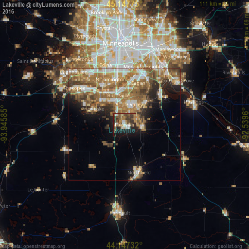

Analysis of Lakeville night lights 2016
Square area 10x10 km:
 5.91%
5.91%90-99
6.21%80-89
3.33%70-79
5.76%60-69
9.55%50-59
10.61%40-49
8.94%30-39
12.12%20-29
12.12%10-19
22.88%0-9
2.58%Square area 50x50 km:
4.34%90-99
4.82%80-89
3.06%70-79
4.06%60-69
7.61%50-59
5.68%40-49
3.78%30-39
3.2%20-29
4.35%10-19
6.75%0-9
52.35%Clear (daylight) street map image can be seen on geolist.org.
Map coordinates:
45° 8' 51.9" North, 93° 56' 45.1" West
44° 38' 58.9" North, 93° 14' 33.8" West
44° 8' 50.4" North, 92° 32' 22.6" West
Some cities around Lakeville sort by population:
• Bloomington
21.7 km =13.5 mi,  348°
348°
• Eagan
18.2 km =11.3 mi,  19°
19°
• Burnsville
13.4 km =8.3 mi, 348°
• Apple Valley
9.4 km =5.8 mi,  12°
12°
• Savage
16.2 km =10.1 mi,  332°
332°
• Prior Lake
15.9 km =9.9 mi,  296°
296°
• Rosemount
13.6 km =8.5 mi,  42°
42°
• Farmington
7.9 km =4.9 mi,  97°
97°
5034059 (p: 60,633)
Sources (retrieved 2019-11-25):
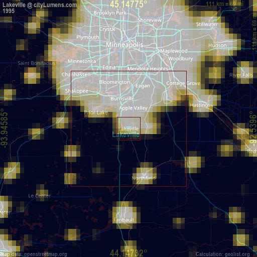
» NASA, Earths city lights 1995
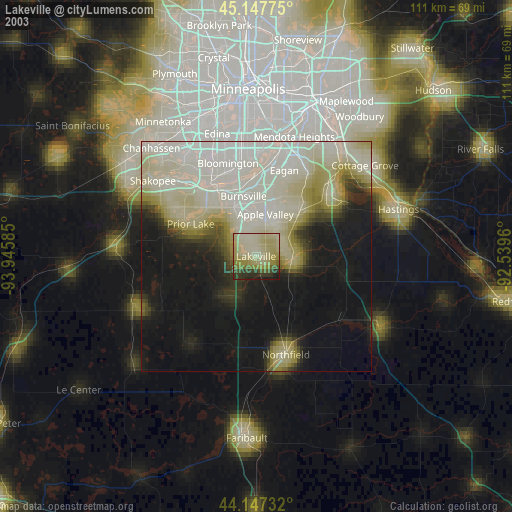
» NASA city lights 2003
» Earth at Night: Flat Maps 2012, 2016