Apple Valley night lights from space
Night Light of Apple Valley (Minnesota) from space (United States) Src. Average luminocity for 10x10km area is 71.9045% and for 50x50km: 42.0349%.
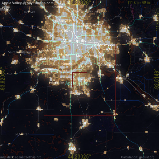
Analysis of Apple Valley night lights 2016
Square area 10x10 km:
 9.09%
9.09%90-99
11.82%80-89
8.33%70-79
11.67%60-69
41.52%50-59
13.64%40-49
2.12%30-39
1.82%20-29
0%10-19
0%0-9
0%Square area 50x50 km:
9.44%90-99
8.78%80-89
4.46%70-79
5.77%60-69
10.11%50-59
7.45%40-49
4.14%30-39
3.16%20-29
4.48%10-19
5.99%0-9
36.21%Clear (daylight) street map image can be seen on geolist.org.
Map coordinates:
45° 13' 45.3" North, 93° 55' 15.1" West
44° 43' 54.9" North, 93° 13' 3.8" West
44° 13' 48.9" North, 92° 30' 52.6" West
Some cities around Apple Valley sort by population:
• Bloomington
13.7 km =8.5 mi,  332°
332°
• Eagan
9 km =5.6 mi,  26°
26°
• Burnsville
6.2 km =3.9 mi,  310°
310°
• Lakeville
9.4 km =5.8 mi,  192°
192°
• Savage
10.7 km =6.6 mi,  299°
299°
• Prior Lake
16.3 km =10.1 mi,  262°
262°
• Rosemount
7.3 km =4.5 mi,  83°
83°
• Farmington
11.8 km =7.3 mi,  150°
150°
5016494 (p: 51,221)
Sources (retrieved 2019-11-25):
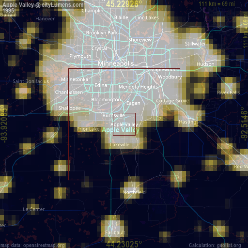
» NASA, Earths city lights 1995
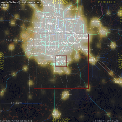
» NASA city lights 2003
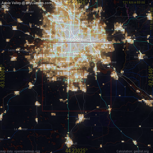
» Earth at Night: Flat Maps 2012, 2016