Austin night lights from space
Night Light of Austin (Texas) from space (United States) Src. Average luminocity for 10x10km area is 94.1245% and for 50x50km: 45.6476%.
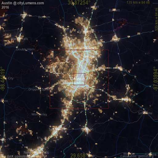
Analysis of Austin night lights 2016
Square area 10x10 km:
 45.05%
90-99
32.6%80-89
13.19%70-79
2.93%60-69
6.04%50-59
0.18%40-49
0%30-39
0%20-29
0%10-19
0%0-9
0%Square area 50x50 km:
7.37%90-99
7.68%80-89
6.32%70-79
7%60-69
8.23%50-59
9.01%40-49
7.31%30-39
6.07%20-29
8.86%10-19
12.71%0-9
19.43%Clear (daylight) street map image can be seen on geolist.org.
Map coordinates:
30° 52' 21.1" North, 98° 26' 46.3" West
30° 16' 1.7" North, 97° 44' 35" West
29° 39' 28.8" North, 97° 2' 23.8" West
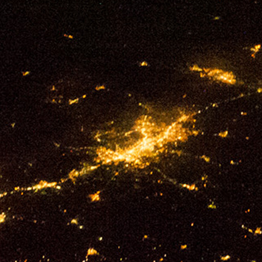
Fantastic image of Austin from space taken by astronauts [src2], but I don't have information about it's orientation, scale or angle. If necessary, it was rotated manually, so North points approximately to upper direction. Click to zoom in:
Some cities around Austin sort by population:
• Jollyville
19.8 km =12.3 mi,  351°
351°
• Buda
22.3 km =13.9 mi,  204°
204°
• Wells Branch
20.8 km =12.9 mi,  17°
17°
• Anderson Mill
21.7 km =13.5 mi,  343°
343°
• Manor
19.7 km =12.2 mi,  65°
65°
• Hornsby Bend
15.5 km =9.6 mi,  98°
98°
• Bee Cave
19.9 km =12.4 mi,  283°
283°
• Shady Hollow
16.1 km =10 mi,  225°
225°
4671654 (p: 931,830)
Sources (retrieved 2019-11-25):
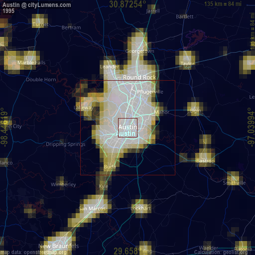
» NASA, Earths city lights 1995
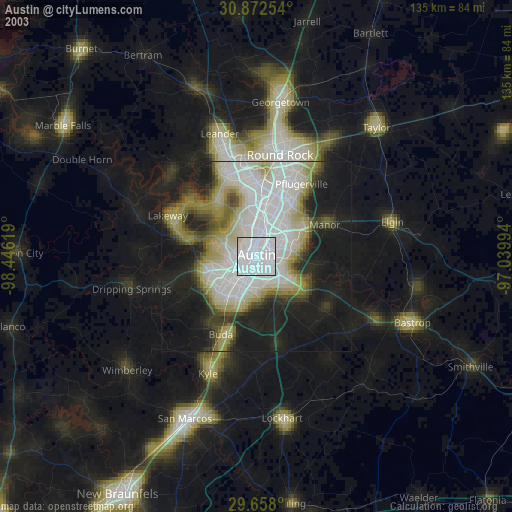
» NASA city lights 2003
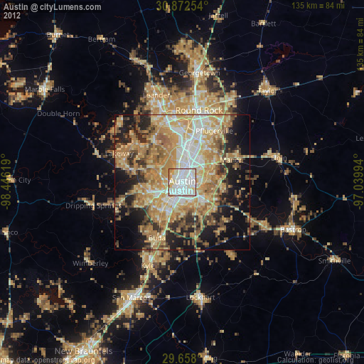
» Earth at Night: Flat Maps 2012, 2016
Src.2: Nasa, Deep in the Heart of Texas 2013