Kennett night lights from space
Night Light of Kennett (Missouri) from space (United States) Src. Average luminocity for 10x10km area is 27.4773% and for 50x50km: 2.8042%.
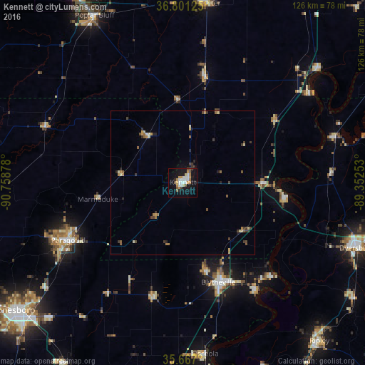
Analysis of Kennett night lights 2016
Square area 10x10 km:
 5.77%
5.77%90-99
4.72%80-89
1.92%70-79
4.55%60-69
3.32%50-59
3.32%40-49
1.75%30-39
1.22%20-29
2.1%10-19
31.47%0-9
39.86%Square area 50x50 km:
0.24%90-99
0.32%80-89
0.37%70-79
0.36%60-69
0.46%50-59
0.41%40-49
0.47%30-39
0.52%20-29
0.41%10-19
1.41%0-9
95.02%Clear (daylight) street map image can be seen on geolist.org.
Map coordinates:
36° 48' 4.5" North, 90° 45' 31.6" West
36° 14' 10.2" North, 90° 3' 20.3" West
35° 40' 1.2" North, 89° 21' 9.1" West
Some cities around Kennett sort by population:
• Paragould
44.3 km =27.5 mi,  243°
243°
• Poplar Bluff
65.3 km =40.6 mi,  332°
332°
• Dyersburg
64.2 km =39.9 mi,  110°
110°
• Blytheville
36.5 km =22.7 mi,  160°
160°
• Ripley
72.2 km =44.9 mi,  139°
139°
• Dexter
62.8 km =39 mi,  7°
7°
• Osceola
59.6 km =37 mi,  172°
172°
• Caruthersville
36.2 km =22.5 mi,  97°
97°
4393451 (p: 10,662)
Sources (retrieved 2019-11-25):
» Earth at Night: Flat Maps 2012, 2016