Kenner night lights from space
Night Light of Kenner (Louisiana) from space (United States) Src. Average luminocity for 10x10km area is 95.0492% and for 50x50km: 38.3289%.
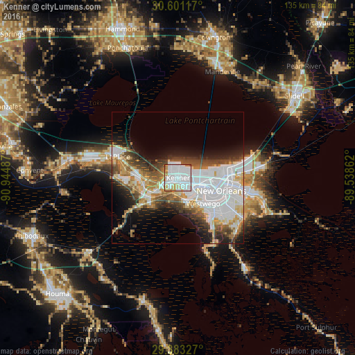
Analysis of Kenner night lights 2016
Square area 10x10 km:
 57.39%
90-99
23.11%80-89
10.23%70-79
5.3%60-69
3.22%50-59
0.76%40-49
0%30-39
0%20-29
0%10-19
0%0-9
0%Square area 50x50 km:
14.55%90-99
6.91%80-89
4.38%70-79
3.43%60-69
4.16%50-59
2.96%40-49
4.73%30-39
4.2%20-29
5.11%10-19
7.92%0-9
41.63%Clear (daylight) street map image can be seen on geolist.org.
Map coordinates:
30° 36' 4.2" North, 90° 56' 41.5" West
29° 59' 38.7" North, 90° 14' 30.3" West
29° 22' 59.8" North, 89° 32' 19" West
Some cities around Kenner sort by population:
• Metairie Terrace
7.7 km =4.8 mi,  102°
102°
• Metairie
8.6 km =5.3 mi, 97°
• River Ridge
4.5 km =2.8 mi,  146°
146°
• Jefferson
9.1 km =5.7 mi,  110°
110°
• Waggaman
8.9 km =5.5 mi,  160°
160°
• Harahan
7 km =4.3 mi, 148°
• Saint Rose
9.4 km =5.8 mi,  236°
236°
• Bridge City
9.7 km =6 mi,  134°
134°
4329753 (p: 67,091)
Sources (retrieved 2019-11-25):
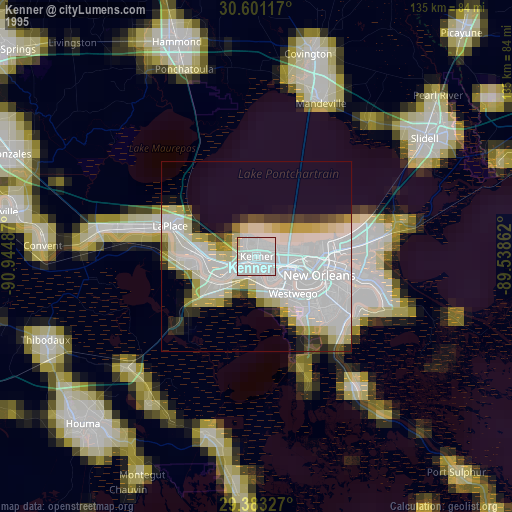
» NASA, Earths city lights 1995
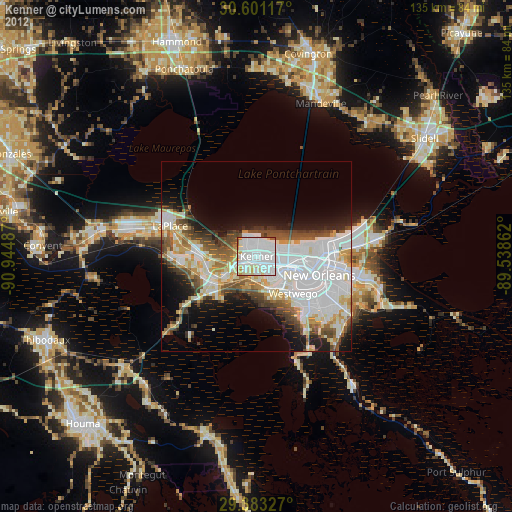
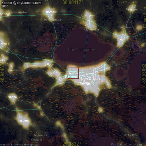
» NASA city lights 2003
» Earth at Night: Flat Maps 2012, 2016