Metairie Terrace night lights from space
Night Light of Metairie Terrace (Louisiana) from space (United States) Src. Average luminocity for 10x10km area is 98.6193% and for 50x50km: 40.5468%.
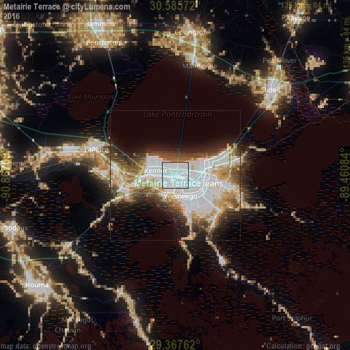
Analysis of Metairie Terrace night lights 2016
Square area 10x10 km:
 75.19%
90-99
21.02%80-89
1.14%70-79
0.38%60-69
2.27%50-59
0%40-49
0%30-39
0%20-29
0%10-19
0%0-9
0%Square area 50x50 km:
15.18%90-99
7.39%80-89
5.04%70-79
4.28%60-69
4.05%50-59
3.05%40-49
5.07%30-39
4.09%20-29
4.85%10-19
7.97%0-9
39.05%Clear (daylight) street map image can be seen on geolist.org.
Map coordinates:
30° 35' 8.6" North, 90° 52' 1.5" West
29° 58' 42.7" North, 90° 9' 50.3" West
29° 22' 3.4" North, 89° 27' 39" West
Some cities around Metairie Terrace sort by population:
• New Orleans
9 km =5.6 mi,  107°
107°
• Kenner
7.7 km =4.8 mi,  282°
282°
• River Ridge
5.4 km =3.4 mi,  247°
247°
• Jefferson
1.7 km =1.1 mi,  143°
143°
• Waggaman
8.1 km =5 mi,  214°
214°
• Harahan
5.7 km =3.5 mi,  221°
221°
• Westwego
8.3 km =5.2 mi,  165°
165°
• Bridge City
5.1 km =3.2 mi,  186°
186°
4333190 (p: 142,489)
Sources (retrieved 2019-11-25):
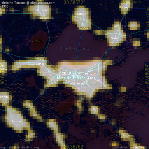
» NASA, Earths city lights 1995
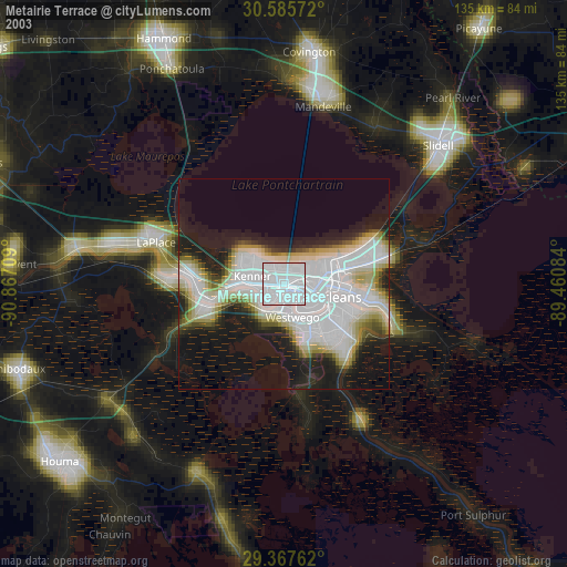
» NASA city lights 2003
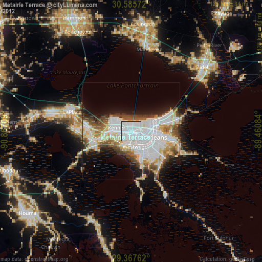
» Earth at Night: Flat Maps 2012, 2016