Metairie night lights from space
Night Light of Metairie (Louisiana) from space (United States) Src. Average luminocity for 10x10km area is 97.714% and for 50x50km: 40.3952%.
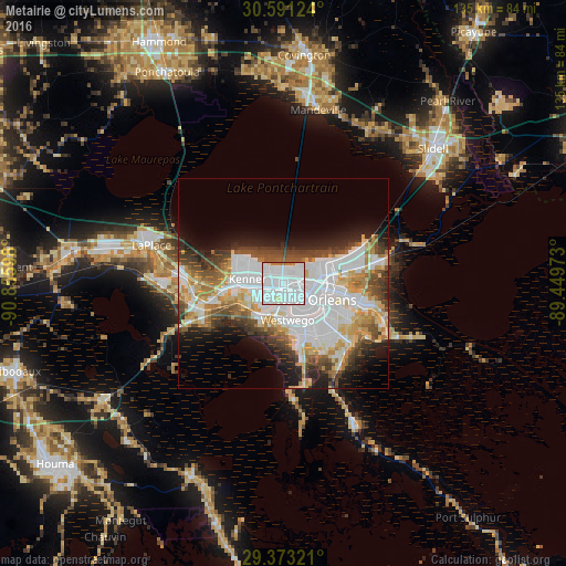
Analysis of Metairie night lights 2016
Square area 10x10 km:
 75.19%
90-99
17.99%80-89
1.52%70-79
0.76%60-69
4.55%50-59
0%40-49
0%30-39
0%20-29
0%10-19
0%0-9
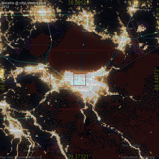
0%Square area 50x50 km:
15.17%90-99
7.38%80-89
4.97%70-79
4.26%60-69
4.05%50-59
3.03%40-49
5.05%30-39
4.05%20-29
4.87%10-19
7.81%0-9
39.37%Clear (daylight) street map image can be seen on geolist.org.
Map coordinates:
30° 35' 28.5" North, 90° 51' 21.5" West
29° 59' 2.7" North, 90° 9' 10.3" West
29° 22' 23.6" North, 89° 26' 59" West
Some cities around Metairie sort by population:
• New Orleans
8.2 km =5.1 mi,  113°
113°
• Kenner
8.6 km =5.3 mi,  277°
277°
• River Ridge
6.6 km =4.1 mi,  246°
246°
• Jefferson
2 km =1.2 mi,  180°
180°
• Waggaman
9.2 km =5.7 mi,  217°
217°
• Harahan
6.9 km =4.3 mi, 224°
• Westwego
8.7 km =5.4 mi,  173°
173°
• Bridge City
5.9 km =3.7 mi,  196°
196°
4333177 (p: 138,481)
Sources (retrieved 2019-11-25):
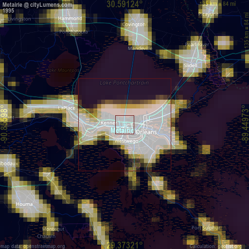
» NASA, Earths city lights 1995
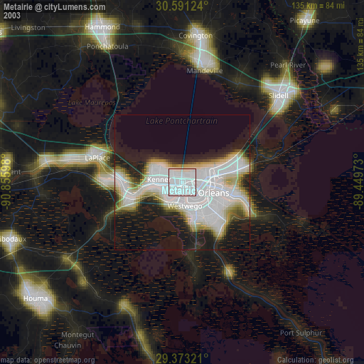
» NASA city lights 2003
» Earth at Night: Flat Maps 2012, 2016