Saint Rose night lights from space
Night Light of Saint Rose (Louisiana) from space (United States) Src. Average luminocity for 10x10km area is 73.4697% and for 50x50km: 33.1697%.
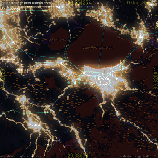
Analysis of Saint Rose night lights 2016
Square area 10x10 km:
 12.5%
12.5%90-99
14.77%80-89
13.26%70-79
13.83%60-69
22.54%50-59
8.14%40-49
11.17%30-39
1.89%20-29
1.89%10-19
0%0-9
0%Square area 50x50 km:
10.78%90-99
5.32%80-89
3.98%70-79
3.61%60-69
4.08%50-59
2.87%40-49
4.54%30-39
4.52%20-29
5.27%10-19
9.73%0-9
45.28%Clear (daylight) street map image can be seen on geolist.org.
Map coordinates:
30° 33' 15.3" North, 91° 1' 34.5" West
29° 56' 48.7" North, 90° 19' 23.3" West
29° 20' 8.7" North, 89° 37' 12" West
Some cities around Saint Rose sort by population:
• Metairie Terrace
15.7 km =9.8 mi,  77°
77°
• Kenner
9.4 km =5.8 mi,  56°
56°
• River Ridge
10.5 km =6.5 mi, 81°
• Luling
4.5 km =2.8 mi,  248°
248°
• Destrehan
2.9 km =1.8 mi,  262°
262°
• Waggaman
11.3 km =7 mi,  106°
106°
• Harahan
11.6 km =7.2 mi,  93°
93°
• Bridge City
14.8 km =9.2 mi,  95°
95°
4340551 (p: 8,122)
Sources (retrieved 2019-11-25):
» Earth at Night: Flat Maps 2012, 2016