Kathleen night lights from space
Night Light of Kathleen (Florida) from space (United States) Src. Average luminocity for 10x10km area is 59.5284% and for 50x50km: 41.4979%.
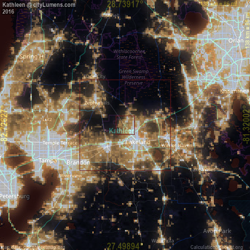
Analysis of Kathleen night lights 2016
Square area 10x10 km:
 6.82%
6.82%90-99
8.9%80-89
3.41%70-79
7.95%60-69
31.63%50-59
12.69%40-49
6.63%30-39
4.92%20-29
8.14%10-19
8.14%0-9
0.76%Square area 50x50 km:
4.36%90-99
5.62%80-89
3.01%70-79
5.06%60-69
17.61%50-59
8.29%40-49
7.6%30-39
6.77%20-29
8.11%10-19
9.27%0-9
24.32%Clear (daylight) street map image can be seen on geolist.org.
Map coordinates:
28° 44' 21" North, 82° 43' 34.6" West
28° 7' 15.1" North, 82° 1' 23.3" West
27° 29' 56.2" North, 81° 19' 12.1" West
Some cities around Kathleen sort by population:
• Lakeland
11.6 km =7.2 mi,  141°
141°
• Plant City
14.5 km =9 mi,  218°
218°
• Lakeland Highlands
19.3 km =12 mi,  158°
158°
• Winston
9.9 km =6.2 mi,  175°
175°
• Medulla
17.7 km =11 mi, 164°
• Combee Settlement
13.5 km =8.4 mi,  121°
121°
• Fussels Corner
17.6 km =10.9 mi,  114°
114°
• Crystal Lake
14.7 km =9.1 mi,  130°
130°
4160651 (p: 6,332)
Sources (retrieved 2019-11-25):
» Earth at Night: Flat Maps 2012, 2016