Irondale night lights from space
Night Light of Irondale (Alabama) from space (United States) Src. Average luminocity for 10x10km area is 81.4286% and for 50x50km: 48.6806%.
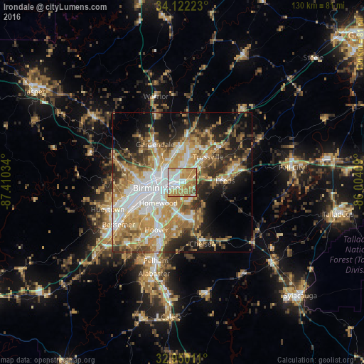
Analysis of Irondale night lights 2016
Square area 10x10 km:
 18.13%
90-99
19.96%80-89
13.74%70-79
23.63%60-69
18.13%50-59
4.21%40-49
1.83%30-39
0.37%20-29
0%10-19
0%0-9
0%Square area 50x50 km:
10%90-99
7.94%80-89
7.58%70-79
9.6%60-69
9.4%50-59
5.1%40-49
5.1%30-39
6.06%20-29
8.12%10-19
11.66%0-9
19.44%Clear (daylight) street map image can be seen on geolist.org.
Map coordinates:
34° 7' 20" North, 87° 24' 37.2" West
33° 32' 17.4" North, 86° 42' 26" West
32° 57' 0.4" North, 86° 0' 14.7" West
Some cities around Irondale sort by population:
• Birmingham
9 km =5.6 mi,  257°
257°
• Homewood
11.4 km =7.1 mi,  229°
229°
• Mountain Brook
5.9 km =3.7 mi, 225°
• Center Point
12.2 km =7.6 mi,  10°
10°
• Fultondale
10.9 km =6.8 mi,  312°
312°
• Brook Highland
11.8 km =7.3 mi,  164°
164°
• Tarrant
7.9 km =4.9 mi, 309°
• Cahaba Heights
8.6 km =5.3 mi,  195°
195°
4069243 (p: 12,423)
Sources (retrieved 2019-11-25):
» Earth at Night: Flat Maps 2012, 2016