Fultondale night lights from space
Night Light of Fultondale (Alabama) from space (United States) Src. Average luminocity for 10x10km area is 79.804% and for 50x50km: 45.5293%.
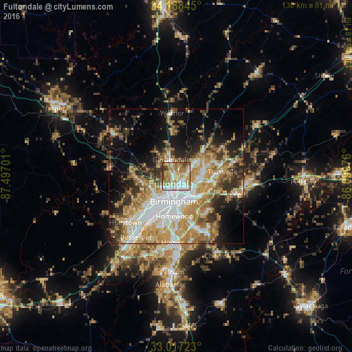
Analysis of Fultondale night lights 2016
Square area 10x10 km:
 21.98%
90-99
14.65%80-89
18.13%70-79
14.47%60-69
16.85%50-59
5.49%40-49
6.41%30-39
2.01%20-29
0%10-19
0%0-9
0%Square area 50x50 km:
9.56%90-99
7.41%80-89
7.01%70-79
8.78%60-69
8.16%50-59
4.76%40-49
4.68%30-39
5.87%20-29
7.37%10-19
11.85%0-9
24.55%Clear (daylight) street map image can be seen on geolist.org.
Map coordinates:
34° 11' 18.4" North, 87° 29' 49.2" West
33° 36' 17.4" North, 86° 47' 38" West
33° 1' 2" North, 86° 5' 26.7" West
Some cities around Fultondale sort by population:
• Birmingham
9.4 km =5.8 mi,  184°
184°
• Mountain Brook
12.2 km =7.6 mi,  161°
161°
• Center Point
11.2 km =7 mi,  66°
66°
• Gardendale
6.4 km =4 mi,  344°
344°
• Irondale
10.9 km =6.8 mi,  132°
132°
• Forestdale
10.2 km =6.3 mi,  247°
247°
• Pinson
13.9 km =8.6 mi,  47°
47°
• Tarrant
3.1 km =1.9 mi,  140°
140°
4063570 (p: 9,048)
Sources (retrieved 2019-11-25):
» Earth at Night: Flat Maps 2012, 2016