Honolulu night lights from space
Night Light of Honolulu (Hawaii) from space (United States) Src. Average luminocity for 10x10km area is 67.0587% and for 50x50km: 19.3655%.
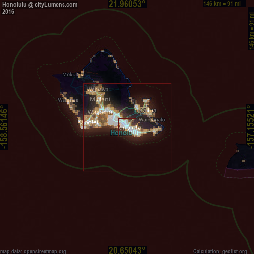
Analysis of Honolulu night lights 2016
Square area 10x10 km:
 22.35%
90-99
22.16%80-89
5.49%70-79
3.79%60-69
3.98%50-59
4.55%40-49
4.36%30-39
10.8%20-29
16.48%10-19
5.87%0-9
0.19%Square area 50x50 km:
3.01%90-99
3.19%80-89
1.94%70-79
3.22%60-69
3.28%50-59
2.43%40-49
2.43%30-39
2.08%20-29
6.95%10-19
11.74%0-9
59.71%Clear (daylight) street map image can be seen on geolist.org.
Map coordinates:
21° 57' 37.9" North, 158° 33' 41.3" West
21° 18' 25" North, 157° 51' 30" West
20° 39' 1.5" North, 157° 9' 18.8" West
Some cities around Honolulu sort by population:
• East Honolulu
14.7 km =9.1 mi,  97°
97°
• Kaneohe
12 km =7.5 mi,  30°
30°
• Hālawa
10.4 km =6.5 mi,  320°
320°
• Waimalu
14 km =8.7 mi, 321°
• Hālawa Heights
9.8 km =6.1 mi, 324°
• ‘Aiea
11.4 km =7.1 mi, 317°
• Hickam Field
11.2 km =7 mi,  289°
289°
• Waimanalo
14.6 km =9.1 mi,  72°
72°
5856195 (p: 371,657)
Sources (retrieved 2019-11-25):
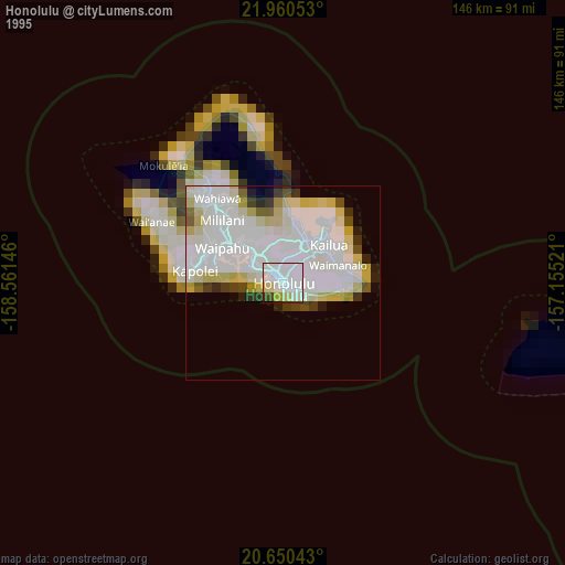
» NASA, Earths city lights 1995
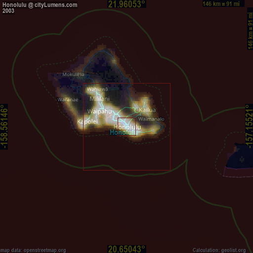
» NASA city lights 2003
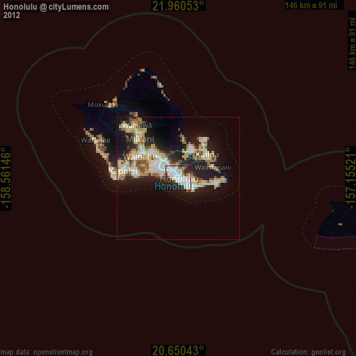
» Earth at Night: Flat Maps 2012, 2016