Waimalu night lights from space
Night Light of Waimalu (Hawaii) from space (United States) Src. Average luminocity for 10x10km area is 55.3466% and for 50x50km: 21.0711%.
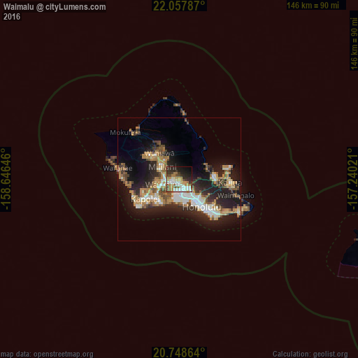
Analysis of Waimalu night lights 2016
Square area 10x10 km:
 10.23%
90-99
13.64%80-89
5.11%70-79
8.71%60-69
11.36%50-59
5.49%40-49
6.25%30-39
6.44%20-29
14.96%10-19
12.5%0-9
5.3%Square area 50x50 km:
3.07%90-99
3.32%80-89
1.94%70-79
3.49%60-69
3.86%50-59
2.71%40-49
2.78%30-39
2.44%20-29
7.29%10-19
13.55%0-9
55.56%Clear (daylight) street map image can be seen on geolist.org.
Map coordinates:
22° 3' 28.3" North, 158° 38' 47.3" West
21° 24' 17" North, 157° 56' 36" West
20° 44' 55.1" North, 157° 14' 24.8" West
Some cities around Waimalu sort by population:
• Pearl City
3.4 km =2.1 mi,  256°
256°
• Waipahu
7.1 km =4.4 mi,  253°
253°
• Royal Kunia
8.7 km =5.4 mi, 262°
• Hālawa
3.6 km =2.2 mi,  141°
141°
• Hālawa Heights
4.2 km =2.6 mi,  133°
133°
• Waipio
6 km =3.7 mi,  284°
284°
• ‘Aiea
2.7 km =1.7 mi,  158°
158°
• Hickam Field
7.4 km =4.6 mi,  193°
193°
5854530 (p: 13,730)
Sources (retrieved 2019-11-25):
» Earth at Night: Flat Maps 2012, 2016