Hightstown night lights from space
Night Light of Hightstown (New Jersey) from space (United States) Src. Average luminocity for 10x10km area is 54.1899% and for 50x50km: 50.6636%.
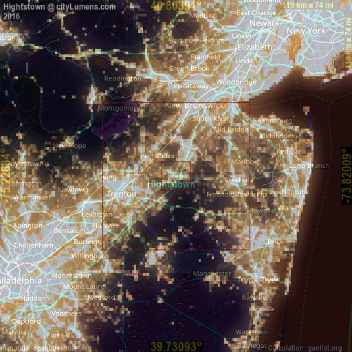
Analysis of Hightstown night lights 2016
Square area 10x10 km:
 4.38%
4.38%90-99
6.33%80-89
8.77%70-79
10.06%60-69
14.29%50-59
13.47%40-49
6.33%30-39
13.96%20-29
12.82%10-19
9.58%0-9
0%Square area 50x50 km:
6.27%90-99
7.35%80-89
7.34%70-79
8.67%60-69
12.02%50-59
12.5%40-49
8.1%30-39
7.54%20-29
8.43%10-19
9.64%0-9
12.13%Clear (daylight) street map image can be seen on geolist.org.
Map coordinates:
40° 48' 14.1" North, 75° 13' 34.8" West
40° 16' 10.4" North, 74° 31' 23.6" West
39° 43' 51.3" North, 73° 49' 12.3" West
Some cities around Hightstown sort by population:
• Mercerville-Hamilton Square
13.3 km =8.3 mi,  251°
251°
• Princeton Meadows
7.7 km =4.8 mi,  333°
333°
• Mercerville
14.3 km =8.9 mi,  255°
255°
• Hamilton Square
12 km =7.5 mi, 246°
• Twin Rivers
2.8 km =1.7 mi,  102°
102°
• Dayton
11.5 km =7.1 mi,  5°
5°
• Jamesburg
11.6 km =7.2 mi,  37°
37°
• Heathcote
14 km =8.7 mi,  341°
341°
5099067 (p: 5,517)
Sources (retrieved 2019-11-25):
» Earth at Night: Flat Maps 2012, 2016