Heathcote night lights from space
Night Light of Heathcote (New Jersey) from space (United States) Src. Average luminocity for 10x10km area is 58.4031% and for 50x50km: 55.5847%.
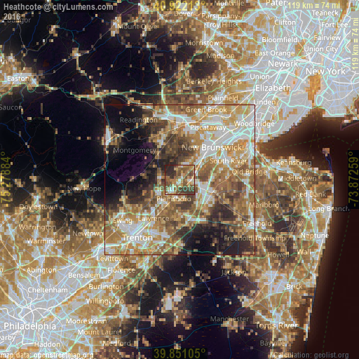
Analysis of Heathcote night lights 2016
Square area 10x10 km:
 3.74%
3.74%90-99
7.14%80-89
9.18%70-79
11.05%60-69
12.76%50-59
20.41%40-49
12.59%30-39
12.59%20-29
10.37%10-19
0.17%0-9
0%Square area 50x50 km:
9.96%90-99
10.84%80-89
7.83%70-79
9.75%60-69
11.12%50-59
10.1%40-49
6.8%30-39
6.73%20-29
6.94%10-19
7.47%0-9
12.46%Clear (daylight) street map image can be seen on geolist.org.
Map coordinates:
40° 55' 19.7" North, 75° 16' 43.8" West
40° 23' 19.4" North, 74° 34' 32.6" West
39° 51' 3.8" North, 73° 52' 21.3" West
Some cities around Heathcote sort by population:
• Princeton
8.3 km =5.2 mi,  237°
237°
• Voorhees
12.9 km =8 mi,  37°
37°
• Princeton Meadows
6.4 km =4 mi,  170°
170°
• Franklin Park
6.6 km =4.1 mi,  31°
31°
• Kendall Park
3.8 km =2.4 mi,  19°
19°
• Dayton
5.8 km =3.6 mi,  107°
107°
• Milltown
13.5 km =8.4 mi,  56°
56°
• Jamesburg
12.2 km =7.6 mi, 109°
5098945 (p: 5,821)
Sources (retrieved 2019-11-25):
» Earth at Night: Flat Maps 2012, 2016