Heber Springs night lights from space
Night Light of Heber Springs (Arkansas) from space (United States) Src. Average luminocity for 10x10km area is 30.2253% and for 50x50km: 2.7216%.
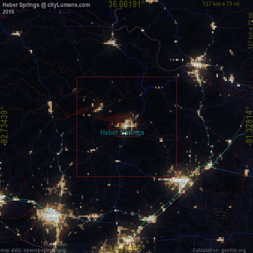
Analysis of Heber Springs night lights 2016
Square area 10x10 km:
 1.28%
1.28%90-99
4.21%80-89
5.86%70-79
3.66%60-69
6.96%50-59
3.11%40-49
5.13%30-39
5.13%20-29
4.4%10-19
31.68%0-9
28.57%Square area 50x50 km:
0.05%90-99
0.24%80-89
0.42%70-79
0.19%60-69
0.49%50-59
0.33%40-49
0.57%30-39
0.84%20-29
0.84%10-19
1.92%0-9
94.11%Clear (daylight) street map image can be seen on geolist.org.
Map coordinates:
36° 3' 42.9" North, 92° 44' 3.8" West
35° 29' 29.3" North, 92° 1' 52.5" West
34° 55' 1" North, 91° 19' 41.3" West
Some cities around Heber Springs sort by population:
• Conway
58.3 km =36.2 mi,  219°
219°
• Jacksonville
69.9 km =43.4 mi,  185°
185°
• Cabot
57.5 km =35.7 mi,  178°
178°
• Searcy
37.8 km =23.5 mi,  135°
135°
• Batesville
46.9 km =29.1 mi,  48°
48°
• Beebe
48.8 km =30.3 mi,  163°
163°
• Newport
69 km =42.9 mi,  79°
79°
• Greenbrier
43.2 km =26.8 mi,  228°
228°
4114225 (p: 7,156)
Sources (retrieved 2019-11-25):
» Earth at Night: Flat Maps 2012, 2016