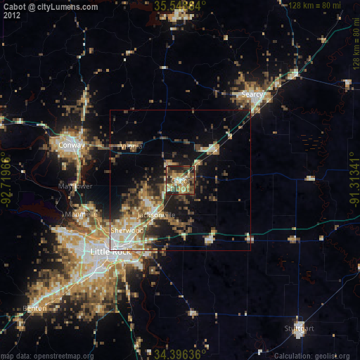
Cabot night lights from space
Night Light of Cabot (Arkansas) from space (United States) Src. Average luminocity for 10x10km area is 53.3004% and for 50x50km: 17.7293%.

Analysis of Cabot night lights 2016
Square area 10x10 km:
 3.85%
3.85%90-99
6.78%80-89
8.42%70-79
10.07%60-69
7.33%50-59
19.05%40-49
6.59%30-39
15.93%20-29
18.86%10-19
3.11%0-9
0%Square area 50x50 km:
2.04%90-99
2.55%80-89
2.16%70-79
2.34%60-69
2.59%50-59
3.3%40-49
2.35%30-39
4.39%20-29
5.1%10-19
8.71%0-9
64.47%Clear (daylight) street map image can be seen on geolist.org.
Map coordinates:
35° 32' 55.1" North, 92° 43' 10.8" West
34° 58' 28.3" North, 92° 0' 59.5" West
34° 23' 46.9" North, 91° 18' 48.3" West
Some cities around Cabot sort by population:
• Little Rock
35.5 km =22.1 mi,  224°
224°
• North Little Rock
32.3 km =20.1 mi,  225°
225°
• Conway
40.8 km =25.4 mi,  288°
288°
• Sherwood
25.9 km =16.1 mi, 226°
• Jacksonville
14.8 km =9.2 mi, 215°
• Searcy
39.9 km =24.8 mi,  39°
39°
• Maumelle
37.3 km =23.2 mi,  251°
251°
• Beebe
16.4 km =10.2 mi,  49°
49°
4103957 (p: 25,587)
Sources (retrieved 2019-11-25):
» Earth at Night: Flat Maps 2012, 2016