Heber City night lights from space
Night Light of Heber City (Utah) from space (United States) Src. Average luminocity for 10x10km area is 18.8486% and for 50x50km: 4.1644%.
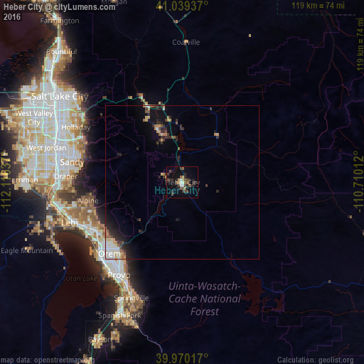
Analysis of Heber City night lights 2016
Square area 10x10 km:
 1.87%
1.87%90-99
1.36%80-89
0.68%70-79
1.53%60-69
2.72%50-59
4.08%40-49
5.44%30-39
4.76%20-29
6.8%10-19
8.67%0-9
62.07%Square area 50x50 km:
0.52%90-99
0.63%80-89
0.41%70-79
0.55%60-69
0.38%50-59
0.52%40-49
0.53%30-39
0.85%20-29
1.58%10-19
2.46%0-9
91.57%Clear (daylight) street map image can be seen on geolist.org.
Map coordinates:
41° 2' 21.7" North, 112° 6' 58.9" West
40° 30' 24.8" North, 111° 24' 47.7" West
39° 58' 12.6" North, 110° 42' 36.4" West
Some cities around Heber City sort by population:
• Orem
33.4 km =20.8 mi,  225°
225°
• Pleasant Grove
31.8 km =19.8 mi,  240°
240°
• Lindon
31.8 km =19.8 mi, 235°
• Cedar Hills
31 km =19.3 mi,  250°
250°
• Alpine
31.4 km =19.5 mi,  259°
259°
• Park City
17 km =10.6 mi,  335°
335°
• Summit Park
31.4 km =19.5 mi,  327°
327°
• Snyderville
23.6 km =14.7 mi, 332°
5775699 (p: 9,198)
Sources (retrieved 2019-11-25):
» Earth at Night: Flat Maps 2012, 2016