Hastings night lights from space
Night Light of Hastings (Michigan) from space (United States) Src. Average luminocity for 10x10km area is 10.9788% and for 50x50km: 2.6417%.
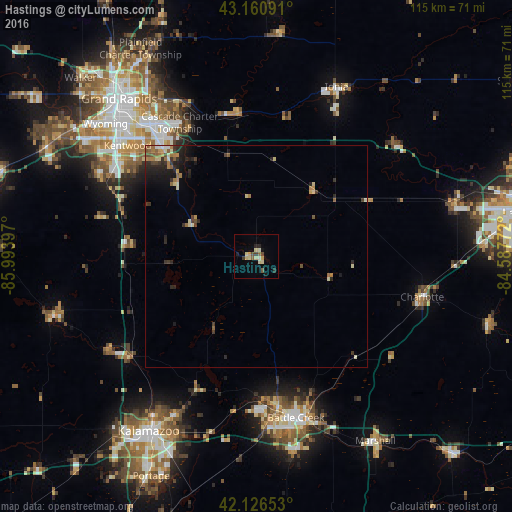
Analysis of Hastings night lights 2016
Square area 10x10 km:
 0%
0%90-99
1.52%80-89
4.39%70-79
0.76%60-69
0.76%50-59
0.76%40-49
1.52%30-39
1.21%20-29
2.42%10-19
1.52%0-9
85.15%Square area 50x50 km:
0.07%90-99
0.28%80-89
0.55%70-79
0.25%60-69
0.49%50-59
0.45%40-49
0.32%30-39
0.53%20-29
1%10-19
1.28%0-9
94.78%Clear (daylight) street map image can be seen on geolist.org.
Map coordinates:
43° 9' 39.3" North, 85° 59' 38.3" West
42° 38' 45.1" North, 85° 17' 27" West
42° 7' 35.5" North, 84° 35' 15.8" West
Some cities around Hastings sort by population:
• Battle Creek
37.7 km =23.4 mi,  165°
165°
• Kentwood
38.1 km =23.7 mi,  310°
310°
• Forest Hills
38.5 km =23.9 mi,  335°
335°
• Cutlerville
37.4 km =23.2 mi, 305°
• Charlotte
38.3 km =23.8 mi,  103°
103°
• Byron Center
39.8 km =24.7 mi,  297°
297°
• Comstock Northwest
40.5 km =25.2 mi,  207°
207°
• Springfield
35.8 km =22.2 mi, 173°
4995520 (p: 7,284)
Sources (retrieved 2019-11-25):
» Earth at Night: Flat Maps 2012, 2016