Hartford City night lights from space
Night Light of Hartford City (Indiana) from space (United States) Src. Average luminocity for 10x10km area is 12.3673% and for 50x50km: 5.837%.
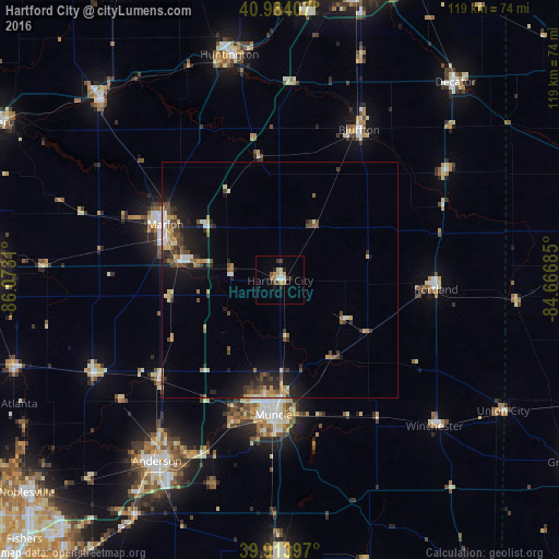
Analysis of Hartford City night lights 2016
Square area 10x10 km:
 0.68%
0.68%90-99
2.04%80-89
2.04%70-79
2.04%60-69
1.36%50-59
1.36%40-49
2.04%30-39
0.68%20-29
4.08%10-19
1.02%0-9
82.65%Square area 50x50 km:
0.44%90-99
0.8%80-89
0.77%70-79
0.62%60-69
0.74%50-59
0.72%40-49
1.22%30-39
0.98%20-29
1.76%10-19
4.06%0-9
87.89%Clear (daylight) street map image can be seen on geolist.org.
Map coordinates:
40° 59' 2.7" North, 86° 4' 23.2" West
40° 27' 4.1" North, 85° 22' 11.9" West
39° 54' 50.3" North, 84° 40' 0.7" West
Some cities around Hartford City sort by population:
• Muncie
28.7 km =17.8 mi,  182°
182°
• Marion
27.2 km =16.9 mi,  295°
295°
• Yorktown
32.6 km =20.3 mi,  198°
198°
• Bluffton
36.1 km =22.4 mi,  27°
27°
• Elwood
44.4 km =27.6 mi,  244°
244°
• Portland
33.2 km =20.6 mi,  93°
93°
• Gas City
20.9 km =13 mi,  281°
281°
• Alexandria
33.3 km =20.7 mi,  231°
231°
4921229 (p: 5,992)
Sources (retrieved 2019-11-25):
» Earth at Night: Flat Maps 2012, 2016