Gas City night lights from space
Night Light of Gas City (Indiana) from space (United States) Src. Average luminocity for 10x10km area is 33.2585% and for 50x50km: 6.7364%.
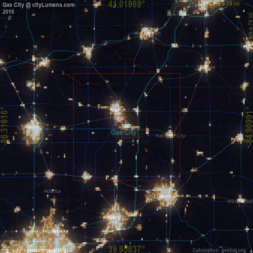
Analysis of Gas City night lights 2016
Square area 10x10 km:
 3.74%
3.74%90-99
5.95%80-89
2.38%70-79
3.23%60-69
6.29%50-59
3.06%40-49
7.14%30-39
7.48%20-29
7.99%10-19
37.24%0-9
15.48%Square area 50x50 km:
0.66%90-99
1.16%80-89
0.88%70-79
0.67%60-69
0.65%50-59
0.8%40-49
1.12%30-39
0.96%20-29
1.65%10-19
4.82%0-9
86.63%Clear (daylight) street map image can be seen on geolist.org.
Map coordinates:
41° 1' 11.6" North, 86° 18' 58.2" West
40° 29' 14.1" North, 85° 36' 46.9" West
39° 57' 1.3" North, 84° 54' 35.7" West
Some cities around Gas City sort by population:
• Muncie
37.9 km =23.5 mi,  149°
149°
• Marion
8.8 km =5.5 mi,  333°
333°
• Yorktown
36.3 km =22.6 mi,  163°
163°
• Wabash
38.7 km =24 mi, 333°
• Elwood
30.4 km =18.9 mi,  219°
219°
• Mount Vernon
27 km =16.8 mi,  318°
318°
• Hartford City
20.9 km =13 mi,  101°
101°
• Alexandria
25.5 km =15.8 mi,  192°
192°
4920637 (p: 5,968)
Sources (retrieved 2019-11-25):
» Earth at Night: Flat Maps 2012, 2016