Harlingen night lights from space
Night Light of Harlingen (Texas) from space (United States) Src. Average luminocity for 10x10km area is 85.6071% and for 50x50km: 25.3451%.
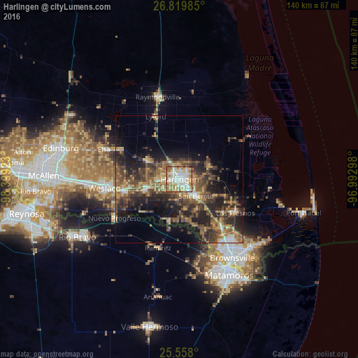
Analysis of Harlingen night lights 2016
Square area 10x10 km:
 24.21%
90-99
24.01%80-89
19.05%70-79
12.3%60-69
16.67%50-59
3.37%40-49
0%30-39
0.4%20-29
0%10-19
0%0-9
0%Square area 50x50 km:
1.95%90-99
2.07%80-89
3.92%70-79
3.39%60-69
4.96%50-59
5.7%40-49
6.07%30-39
5.88%20-29
8.73%10-19
11.18%0-9
46.14%Clear (daylight) street map image can be seen on geolist.org.
Map coordinates:
26° 49' 11.5" North, 98° 23' 57.2" West
26° 11' 26.3" North, 97° 41' 46" West
25° 33' 28.8" North, 96° 59' 34.7" West
Some cities around Harlingen sort by population:
• Weslaco
29.6 km =18.4 mi,  263°
263°
• San Benito
9.2 km =5.7 mi,  134°
134°
• Mercedes
22.2 km =13.8 mi, 258°
• Nuevo Progreso, MX
29.7 km =18.5 mi,  239°
239°
• La Feria
13.2 km =8.2 mi,  254°
254°
• Los Fresnos
25.6 km =15.9 mi,  121°
121°
• Mila Doce
26.5 km =16.5 mi,  278°
278°
• Progreso
28.3 km =17.6 mi, 247°
4696233 (p: 65,774)
Sources (retrieved 2019-11-25):
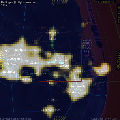
» NASA, Earths city lights 1995
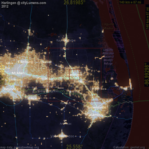
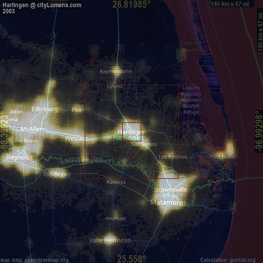
» NASA city lights 2003
» Earth at Night: Flat Maps 2012, 2016