Hamtramck night lights from space
Night Light of Hamtramck (Michigan) from space (United States) Src. Average luminocity for 10x10km area is 99.8063% and for 50x50km: 70.6973%.
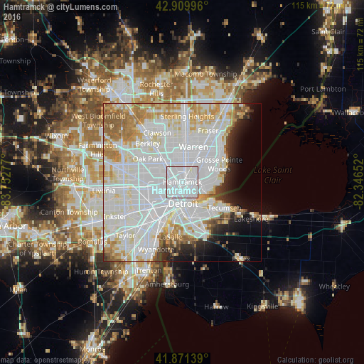
Analysis of Hamtramck night lights 2016
Square area 10x10 km:
 90.32%
90-99
9.68%80-89
0%70-79
0%60-69
0%50-59
0%40-49
0%30-39
0%20-29
0%10-19
0%0-9
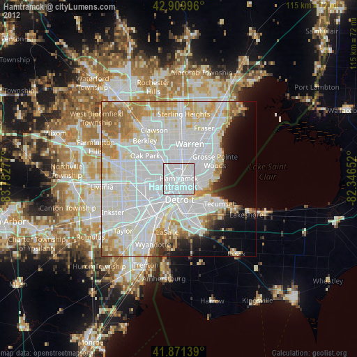
0%Square area 50x50 km:
33.59%90-99
19.59%80-89
5.91%70-79
6.02%60-69
5.3%50-59
3.21%40-49
1.74%30-39
2.03%20-29
3.53%10-19
4.83%0-9
14.25%Clear (daylight) street map image can be seen on geolist.org.
Map coordinates:
42° 54' 35.9" North, 83° 45' 10" West
42° 23' 34.2" North, 83° 2' 58.7" West
41° 52' 17" North, 82° 20' 47.5" West
Some cities around Hamtramck sort by population:
• Detroit
6.8 km =4.2 mi,  177°
177°
• Windsor, CA
10.7 km =6.6 mi,  165°
165°
• Ferndale
10.3 km =6.4 mi,  317°
317°
• Hazel Park
8.9 km =5.5 mi,  330°
330°
• Harper Woods
11.2 km =7 mi,  66°
66°
• Grosse Pointe Park
9.4 km =5.8 mi,  101°
101°
• Highland Park
4.1 km =2.5 mi,  290°
290°
• Center Line
10.4 km =6.5 mi,  9°
9°
4995197 (p: 22,002)
Sources (retrieved 2019-11-25):
» Earth at Night: Flat Maps 2012, 2016