Hamilton night lights from space
Night Light of Hamilton (Alabama) from space (United States) Src. Average luminocity for 10x10km area is 26.2857% and for 50x50km: 3.1098%.
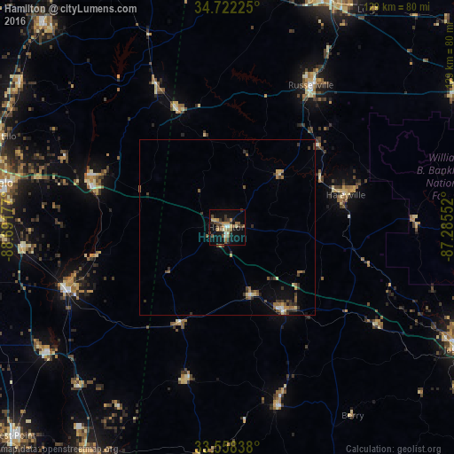
Analysis of Hamilton night lights 2016
Square area 10x10 km:
 2.01%
2.01%90-99
1.1%80-89
4.76%70-79
3.3%60-69
4.76%50-59
5.68%40-49
4.76%30-39
5.49%20-29
4.21%10-19
24.91%0-9
39.01%Square area 50x50 km:
0.13%90-99
0.14%80-89
0.5%70-79
0.31%60-69
0.62%50-59
0.61%40-49
0.58%30-39
0.9%20-29
0.48%10-19
1.5%0-9
94.23%Clear (daylight) street map image can be seen on geolist.org.
Map coordinates:
34° 43' 20.1" North, 88° 41' 30.4" West
34° 8' 32.4" North, 87° 59' 19.1" West
33° 33' 30.2" North, 87° 17' 7.9" West
Some cities around Hamilton sort by population:
• Tupelo
67.1 km =41.7 mi,  281°
281°
• Jasper
74.1 km =46 mi,  117°
117°
• Muscle Shoals
73.2 km =45.5 mi,  23°
23°
• Russellville
47.1 km =29.3 mi,  30°
30°
• Tuscumbia
70.5 km =43.8 mi, 21°
• Amory
49.2 km =30.6 mi,  249°
249°
• Aberdeen
62.1 km =38.6 mi,  235°
235°
• Saltillo
68.8 km =42.8 mi,  292°
292°
4065965 (p: 6,772)
Sources (retrieved 2019-11-25):
» Earth at Night: Flat Maps 2012, 2016