Hamburg night lights from space
Night Light of Hamburg (New York) from space (United States) Src. Average luminocity for 10x10km area is 36.2182% and for 50x50km: 19.4426%.
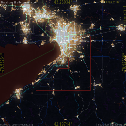
Analysis of Hamburg night lights 2016
Square area 10x10 km:
 1.97%
1.97%90-99
4.7%80-89
3.79%70-79
3.94%60-69
5.76%50-59
9.7%40-49
12.27%30-39
7.42%20-29
9.24%10-19
25%0-9
16.21%Square area 50x50 km:
4.13%90-99
3.31%80-89
1.97%70-79
2.46%60-69
3.22%50-59
3.02%40-49
2.8%30-39
2.46%20-29
3.65%10-19
6.11%0-9
66.85%Clear (daylight) street map image can be seen on geolist.org.
Map coordinates:
43° 13' 49.2" North, 79° 31' 57.4" West
42° 42' 57.2" North, 78° 49' 46.1" West
42° 11' 49.7" North, 78° 7' 34.9" West
Some cities around Hamburg sort by population:
• Buffalo
19.4 km =12.1 mi,  348°
348°
• Cheektowaga
21.7 km =13.5 mi,  16°
16°
• West Seneca
15.1 km =9.4 mi,  9°
9°
• Lackawanna
12.2 km =7.6 mi,  2°
2°
• Fort Erie, CA
22.2 km =13.8 mi,  337°
337°
• Depew
23.7 km =14.7 mi,  28°
28°
• Boston
12.2 km =7.6 mi,  142°
142°
• East Aurora
18.6 km =11.6 mi,  71°
71°
5119833 (p: 9,576)
Sources (retrieved 2019-11-25):
» Earth at Night: Flat Maps 2012, 2016