Bentonville night lights from space
Night Light of Bentonville (Arkansas) from space (United States) Src. Average luminocity for 10x10km area is 70% and for 50x50km: 19.7579%.
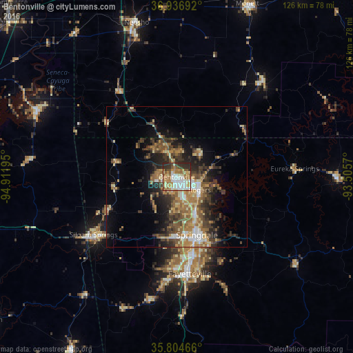
Analysis of Bentonville night lights 2016
Square area 10x10 km:
 14.86%
90-99
15.38%80-89
10.84%70-79
12.94%60-69
14.51%50-59
9.62%40-49
3.15%30-39
8.57%20-29
9.97%10-19
0.17%0-9
0%Square area 50x50 km:
1.91%90-99
2.45%80-89
2.96%70-79
2.66%60-69
3.69%50-59
3.68%40-49
3.61%30-39
5.21%20-29
4.97%10-19
7.75%0-9
61.11%Clear (daylight) street map image can be seen on geolist.org.
Map coordinates:
36° 56' 12.9" North, 94° 54' 43" West
36° 22' 22.3" North, 94° 12' 31.8" West
35° 48' 16.8" North, 93° 30' 20.5" West
Some cities around Bentonville sort by population:
• Fayetteville
34.8 km =21.6 mi,  172°
172°
• Springdale
21.9 km =13.6 mi,  160°
160°
• Rogers
9.3 km =5.8 mi,  119°
119°
• Bella Vista
13.2 km =8.2 mi,  334°
334°
• Siloam Springs
36.1 km =22.4 mi,  235°
235°
• Centerton
7 km =4.3 mi,  258°
258°
• Lowell
14.8 km =9.2 mi,  151°
151°
• Pea Ridge
12.3 km =7.6 mi,  42°
42°
4101260 (p: 44,499)
Sources (retrieved 2019-11-25):
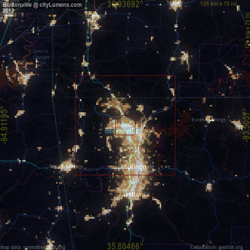
» Earth at Night: Flat Maps 2012, 2016