Bella Vista night lights from space
Night Light of Bella Vista (Arkansas) from space (United States) Src. Average luminocity for 10x10km area is 34.6007% and for 50x50km: 13.9187%.
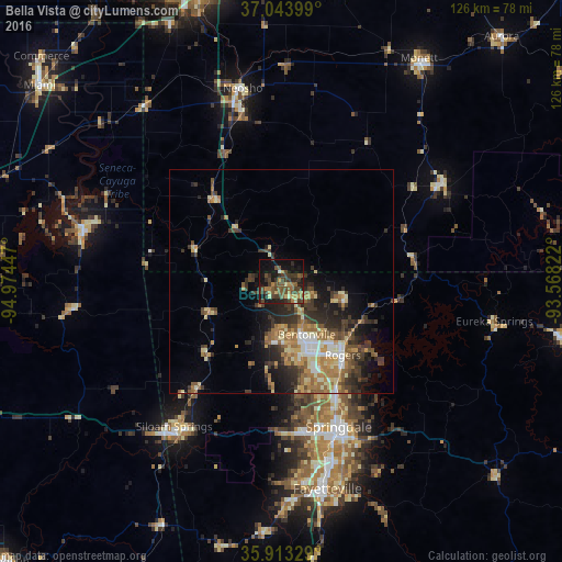

Analysis of Bella Vista night lights 2016
Square area 10x10 km:
 0.37%
0.37%90-99
1.28%80-89
4.21%70-79
4.21%60-69
5.13%50-59
10.62%40-49
15.02%30-39
11.9%20-29
8.06%10-19
25.64%0-9
13.55%Square area 50x50 km:
1.09%90-99
1.67%80-89
2.09%70-79
2.03%60-69
2.56%50-59
2.52%40-49
2.31%30-39
3.82%20-29
3.79%10-19
5.77%0-9
72.33%Clear (daylight) street map image can be seen on geolist.org.
Map coordinates:
37° 2' 38.4" North, 94° 58' 28.1" West
36° 28' 50.5" North, 94° 16' 16.8" West
35° 54' 47.8" North, 93° 34' 5.6" West
Some cities around Bella Vista sort by population:
• Springdale
35.1 km =21.8 mi,  158°
158°
• Rogers
21.5 km =13.4 mi,  140°
140°
• Bentonville
13.2 km =8.2 mi,  154°
154°
• Siloam Springs
40.5 km =25.2 mi,  216°
216°
• Neosho
44 km =27.3 mi,  348°
348°
• Centerton
13.5 km =8.4 mi,  185°
185°
• Lowell
28 km =17.4 mi, 153°
• Pea Ridge
14.3 km =8.9 mi,  102°
102°
4101114 (p: 27,999)
Sources (retrieved 2019-11-25):
» Earth at Night: Flat Maps 2012, 2016