Lents night lights from space
Night Light of Lents (Oregon) from space (United States) Src. Average luminocity for 10x10km area is 86.9524% and for 50x50km: 43.6749%.
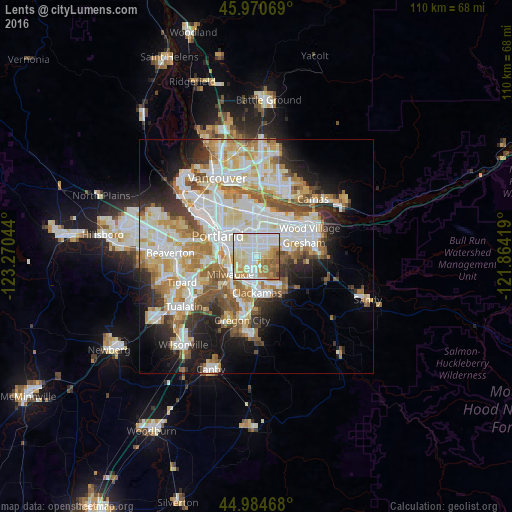
Analysis of Lents night lights 2016
Square area 10x10 km:
 29.21%
90-99
29.21%80-89
11.43%70-79
12.06%60-69
12.38%50-59
4.44%40-49
1.27%30-39
0%20-29
0%10-19
0%0-9
0%Square area 50x50 km:
11.35%90-99
11.79%80-89
5.25%70-79
5.89%60-69
5.53%50-59
4.7%40-49
3.56%30-39
3.27%20-29
5.48%10-19
9.51%0-9
33.66%Clear (daylight) street map image can be seen on geolist.org.
Map coordinates:
45° 58' 14.5" North, 123° 16' 13.6" West
45° 28' 47.4" North, 122° 34' 2.3" West
44° 59' 4.8" North, 121° 51' 51.1" West
Some cities around Lents sort by population:
• Portland
9.8 km =6.1 mi,  299°
299°
• Lake Oswego
10.4 km =6.5 mi,  230°
230°
• Milwaukie
6.7 km =4.2 mi,  236°
236°
• Happy Valley
4.7 km =2.9 mi,  141°
141°
• Oak Grove
9 km =5.6 mi,  219°
219°
• Oatfield
7.7 km =4.8 mi,  199°
199°
• Jennings Lodge
10.5 km =6.5 mi, 199°
• Clackamas
8 km =5 mi,  181°
181°
5736378 (p: 20,156)
Sources (retrieved 2019-11-25):
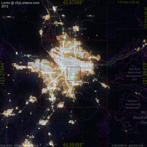
» Earth at Night: Flat Maps 2012, 2016