Granite Shoals night lights from space
Night Light of Granite Shoals (Texas) from space (United States) Src. Average luminocity for 10x10km area is 21.7985% and for 50x50km: 4.3283%.
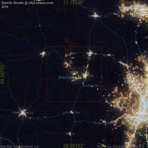
Analysis of Granite Shoals night lights 2016
Square area 10x10 km:
 0%
0%90-99
0.55%80-89
2.38%70-79
2.38%60-69
3.48%50-59
6.96%40-49
6.04%30-39
7.33%20-29
4.58%10-19
21.43%0-9
44.87%Square area 50x50 km:
0.14%90-99
0.22%80-89
0.59%70-79
0.5%60-69
0.47%50-59
1.08%40-49
0.98%30-39
1.06%20-29
0.79%10-19
3.04%0-9
91.15%Clear (daylight) street map image can be seen on geolist.org.
Map coordinates:
31° 11' 32.9" North, 99° 5' 13.4" West
30° 35' 20.7" North, 98° 23' 2.1" West
29° 58' 54.9" North, 97° 40' 50.9" West
Some cities around Granite Shoals sort by population:
• Cedar Park
54.8 km =34.1 mi,  99°
99°
• Leander
50.8 km =31.6 mi,  91°
91°
• Lakeway
46.1 km =28.6 mi,  122°
122°
• Lago Vista
40.5 km =25.2 mi,  110°
110°
• Bee Cave
52.4 km =32.6 mi,  126°
126°
• Marble Falls
10.5 km =6.5 mi, 96°
• Burnet
24 km =14.9 mi,  38°
38°
• Kingsland
9.4 km =5.8 mi,  324°
324°
4694535 (p: 5,071)
Sources (retrieved 2019-11-25):
» Earth at Night: Flat Maps 2012, 2016