Glenwood Springs night lights from space
Night Light of Glenwood Springs (Colorado) from space (United States) Src. Average luminocity for 10x10km area is 12.6623% and for 50x50km: 1.0505%.
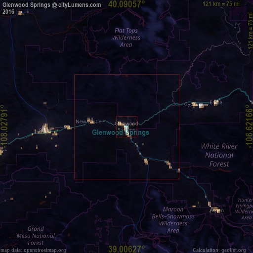
Analysis of Glenwood Springs night lights 2016
Square area 10x10 km:
 1.95%
1.95%90-99
1.3%80-89
0.65%70-79
2.92%60-69
2.27%50-59
0.16%40-49
2.11%30-39
3.57%20-29
0.65%10-19
1.62%0-9
82.79%Square area 50x50 km:
0.08%90-99
0.05%80-89
0.07%70-79
0.24%60-69
0.24%50-59
0.09%40-49
0.22%30-39
0.43%20-29
0.05%10-19
0.15%0-9
98.38%Clear (daylight) street map image can be seen on geolist.org.
Map coordinates:
40° 5' 26.1" North, 108° 1' 40.5" West
39° 33' 1.9" North, 107° 19' 29.2" West
39° 0' 22.6" North, 106° 37' 18" West
Some cities around Glenwood Springs sort by population:
• Edwards
63.5 km =39.5 mi,  80°
80°
• Rifle
39.3 km =24.4 mi,  267°
267°
• Gypsum
33.7 km =20.9 mi,  71°
71°
• Aspen
59.1 km =36.7 mi,  132°
132°
• Eagle
44.1 km =27.4 mi, 74°
• Carbondale
19.2 km =11.9 mi,  149°
149°
• Avon
69.3 km =43.1 mi, 82°
• Vail
82.1 km =51 mi, 83°
5423092 (p: 9,906)
Sources (retrieved 2019-11-25):
» Earth at Night: Flat Maps 2012, 2016