Rifle night lights from space
Night Light of Rifle (Colorado) from space (United States) Src. Average luminocity for 10x10km area is 16.9692% and for 50x50km: 1.6723%.
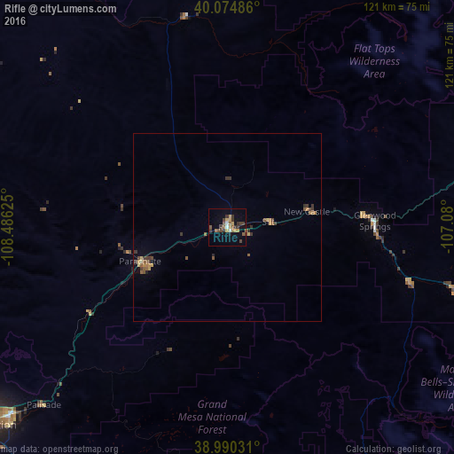
Analysis of Rifle night lights 2016
Square area 10x10 km:
 1.14%
1.14%90-99
0.81%80-89
3.08%70-79
1.79%60-69
1.79%50-59
4.22%40-49
3.73%30-39
5.68%20-29
0.81%10-19
5.36%0-9
71.59%Square area 50x50 km:
0.05%90-99
0.05%80-89
0.28%70-79
0.22%60-69
0.25%50-59
0.51%40-49
0.29%30-39
0.64%20-29
0.13%10-19
0.25%0-9
97.33%Clear (daylight) street map image can be seen on geolist.org.
Map coordinates:
40° 4' 29.5" North, 108° 29' 10.5" West
39° 32' 4.9" North, 107° 46' 59.2" West
38° 59' 25.1" North, 107° 4' 48" West
Some cities around Rifle sort by population:
• Grand Junction
84.3 km =52.4 mi,  231°
231°
• Clifton
75.5 km =46.9 mi, 229°
• Glenwood Springs
39.3 km =24.4 mi,  87°
87°
• Fruitvale
79.4 km =49.3 mi, 230°
• Gypsum
72.3 km =44.9 mi,  80°
80°
• Orchard Mesa
85.8 km =53.3 mi, 230°
• Eagle
82.9 km =51.5 mi, 80°
• Carbondale
51.3 km =31.9 mi,  106°
106°
5436363 (p: 9,563)
Sources (retrieved 2019-11-25):
» Earth at Night: Flat Maps 2012, 2016