Gardendale night lights from space
Night Light of Gardendale (Alabama) from space (United States) Src. Average luminocity for 10x10km area is 54.3663% and for 50x50km: 38.581%.
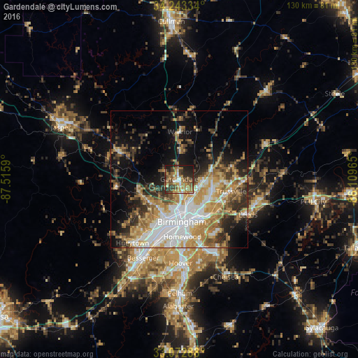
Analysis of Gardendale night lights 2016
Square area 10x10 km:
 4.76%
4.76%90-99
4.76%80-89
7.51%70-79
10.81%60-69
19.05%50-59
7.69%40-49
13.19%30-39
10.99%20-29
12.09%10-19
9.16%0-9
0%Square area 50x50 km:
8.26%90-99
6.02%80-89
5.51%70-79
6.7%60-69
6.32%50-59
4.23%40-49
4.46%30-39
5.69%20-29
7.02%10-19
12.21%0-9
33.58%Clear (daylight) street map image can be seen on geolist.org.
Map coordinates:
34° 14' 36" North, 87° 30' 57.2" West
33° 39' 36.4" North, 86° 48' 46" West
33° 4' 22.4" North, 86° 6' 34.7" West
Some cities around Gardendale sort by population:
• Birmingham
15.5 km =9.6 mi,  176°
176°
• Center Point
12.1 km =7.5 mi,  97°
97°
• Irondale
16.7 km =10.4 mi,  144°
144°
• Forestdale
12.7 km =7.9 mi,  217°
217°
• Fultondale
6.4 km =4 mi,  164°
164°
• Pinson
12.4 km =7.7 mi,  74°
74°
• Tarrant
9.3 km =5.8 mi, 156°
• Grayson Valley
16.1 km =10 mi,  94°
94°
4063765 (p: 13,711)
Sources (retrieved 2019-11-25):
» Earth at Night: Flat Maps 2012, 2016