Gainesville night lights from space
Night Light of Gainesville (Texas) from space (United States) Src. Average luminocity for 10x10km area is 37.8956% and for 50x50km: 4.2483%.
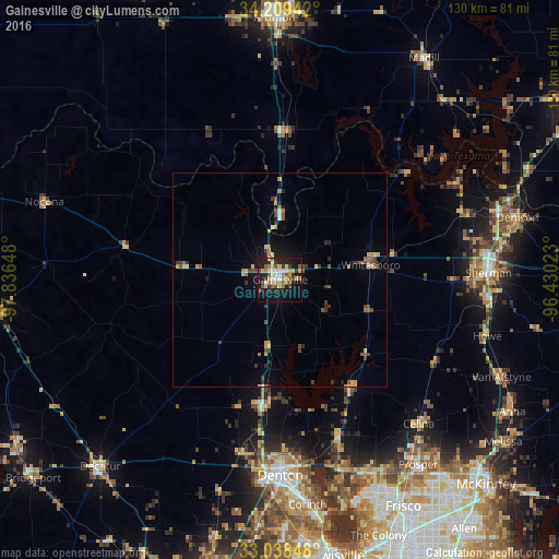
Analysis of Gainesville night lights 2016
Square area 10x10 km:
 3.85%
3.85%90-99
5.86%80-89
7.51%70-79
4.95%60-69
5.86%50-59
6.96%40-49
3.3%30-39
5.86%20-29
5.13%10-19
37.36%0-9
13.37%Square area 50x50 km:
0.22%90-99
0.33%80-89
0.78%70-79
0.49%60-69
0.48%50-59
0.93%40-49
0.74%30-39
0.85%20-29
0.6%10-19
2.66%0-9
91.92%Clear (daylight) street map image can be seen on geolist.org.
Map coordinates:
34° 12' 33.9" North, 97° 50' 11.3" West
33° 37' 33.4" North, 97° 8' 0.1" West
33° 2' 18.5" North, 96° 25' 48.8" West
Some cities around Gainesville sort by population:
• Denton
45.7 km =28.4 mi,  179°
179°
• Sherman
48.6 km =30.2 mi,  88°
88°
• Little Elm
54.6 km =33.9 mi,  160°
160°
• Denison
57.1 km =35.5 mi,  75°
75°
• Corinth
52.9 km =32.9 mi,  173°
173°
• Prosper
53.2 km =33.1 mi,  144°
144°
• Sanger
29.5 km =18.3 mi,  187°
187°
• Celina
46.6 km =29 mi, 136°
4692746 (p: 16,292)
Sources (retrieved 2019-11-25):
» Earth at Night: Flat Maps 2012, 2016