Sanger night lights from space
Night Light of Sanger (Texas) from space (United States) Src. Average luminocity for 10x10km area is 21.785% and for 50x50km: 14.0648%.
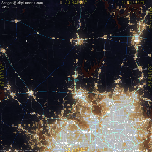
Analysis of Sanger night lights 2016
Square area 10x10 km:
 1.57%
1.57%90-99
2.1%80-89
3.5%70-79
1.92%60-69
2.62%50-59
1.75%40-49
5.42%30-39
6.82%20-29
1.22%10-19
27.45%0-9
45.63%Square area 50x50 km:
1.28%90-99
1.43%80-89
2.49%70-79
2.21%60-69
2.26%50-59
2.57%40-49
2.65%30-39
2.95%20-29
3.46%10-19
6.54%0-9
72.16%Clear (daylight) street map image can be seen on geolist.org.
Map coordinates:
33° 56' 54.3" North, 97° 52' 37.3" West
33° 21' 47.4" North, 97° 10' 26" West
32° 46' 26.2" North, 96° 28' 14.8" West
Some cities around Sanger sort by population:
• Denton
16.9 km =10.5 mi,  167°
167°
• Little Elm
31.3 km =19.4 mi,  135°
135°
• Corinth
25.4 km =15.8 mi,  156°
156°
• Gainesville
29.5 km =18.3 mi,  7°
7°
• Highland Village
32.4 km =20.1 mi, 158°
• Lake Dallas
30.4 km =18.9 mi,  153°
153°
• Celina
36.4 km =22.6 mi,  96°
96°
• Lantana
30.6 km =19 mi, 171°
4726957 (p: 7,747)
Sources (retrieved 2019-11-25):
» Earth at Night: Flat Maps 2012, 2016