Fresno night lights from space
Night Light of Fresno (California) from space (United States) Src. Average luminocity for 10x10km area is 92.7343% and for 50x50km: 23.334%.
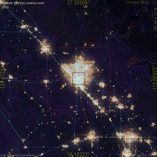
Analysis of Fresno night lights 2016
Square area 10x10 km:
 34.44%
90-99
38.11%80-89
16.26%70-79
5.24%60-69
3.5%50-59
1.92%40-49
0.52%30-39
0%20-29
0%10-19
0%0-9
0%Square area 50x50 km:
3.99%90-99
4.75%80-89
2.47%70-79
4.42%60-69
3.31%50-59
2.4%40-49
2.81%30-39
2.86%20-29
3.46%10-19
12.05%0-9
57.48%Clear (daylight) street map image can be seen on geolist.org.
Map coordinates:
37° 18' 32.6" North, 120° 28' 31.8" West
36° 44' 51.8" North, 119° 46' 20.5" West
36° 10' 56.2" North, 119° 4' 9.3" West
Some cities around Fresno sort by population:
• Clovis
10.6 km =6.6 mi,  35°
35°
• Sanger
19.8 km =12.3 mi,  102°
102°
• Selma
24.3 km =15.1 mi,  143°
143°
• Parlier
26.6 km =16.5 mi,  124°
124°
• Kerman
25.8 km =16 mi,  264°
264°
• Bonadelle Ranchos-Madera Ranchos
27.9 km =17.3 mi,  340°
340°
• Fowler
15.5 km =9.6 mi,  147°
147°
• Old Fig Garden
6.4 km =4 mi,  332°
332°
5350937 (p: 520,052)
Sources (retrieved 2019-11-25):
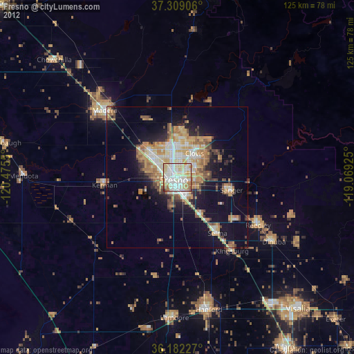
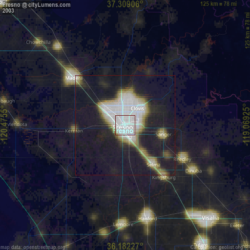
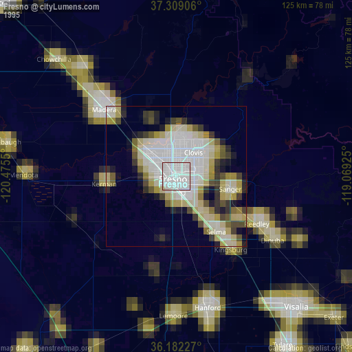
» NASA, Earths city lights 1995
» NASA city lights 2003
» Earth at Night: Flat Maps 2012, 2016