Fowler night lights from space
Night Light of Fowler (California) from space (United States) Src. Average luminocity for 10x10km area is 25.4835% and for 50x50km: 21.9079%.
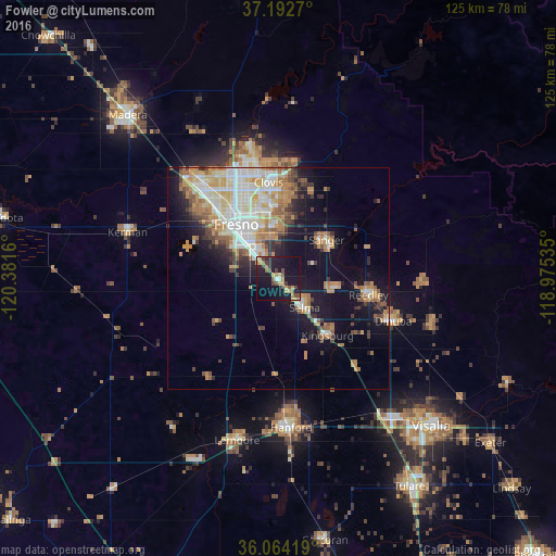
Analysis of Fowler night lights 2016
Square area 10x10 km:
 0.92%
0.92%90-99
0.92%80-89
1.65%70-79
6.96%60-69
3.48%50-59
4.58%40-49
6.04%30-39
4.58%20-29
3.85%10-19
42.67%0-9
24.36%Square area 50x50 km:
3.87%90-99
4.59%80-89
2.27%70-79
4.27%60-69
3.11%50-59
2.26%40-49
2.46%30-39
2.31%20-29
2.64%10-19
11.25%0-9
60.96%Clear (daylight) street map image can be seen on geolist.org.
Map coordinates:
37° 11' 33.7" North, 120° 22' 53.8" West
36° 37' 49.8" North, 119° 40' 42.5" West
36° 3' 51.1" North, 118° 58' 31.3" West
Some cities around Fowler sort by population:
• Fresno
15.5 km =9.6 mi,  327°
327°
• Clovis
21.8 km =13.5 mi,  354°
354°
• Reedley
20.7 km =12.9 mi,  100°
100°
• Sanger
13.9 km =8.6 mi,  51°
51°
• Selma
8.9 km =5.5 mi,  138°
138°
• Parlier
13.7 km =8.5 mi, 98°
• Kingsburg
17.1 km =10.6 mi, 139°
• Old Fig Garden
21.9 km =13.6 mi, 328°
5350351 (p: 6,266)
Sources (retrieved 2019-11-25):
» Earth at Night: Flat Maps 2012, 2016