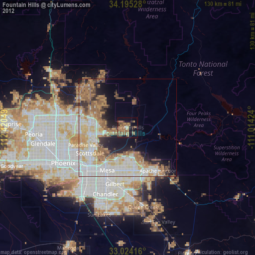
Fountain Hills night lights from space
Night Light of Fountain Hills (Arizona) from space (United States) Src. Average luminocity for 10x10km area is 37.2418% and for 50x50km: 35.803%.
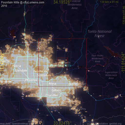
Analysis of Fountain Hills night lights 2016
Square area 10x10 km:
 0.92%
0.92%90-99
2.01%80-89
0.73%70-79
6.41%60-69
12.82%50-59
19.05%40-49
6.78%30-39
6.04%20-29
5.68%10-19
23.44%0-9
16.12%Square area 50x50 km:
8.21%90-99
8.29%80-89
4.03%70-79
4.57%60-69
6.12%50-59
6.9%40-49
2.9%30-39
3.37%20-29
4.36%10-19
7.64%0-9
43.61%Clear (daylight) street map image can be seen on geolist.org.
Map coordinates:
34° 11' 43" North, 112° 25' 13.8" West
33° 36' 42.2" North, 111° 43' 2.5" West
33° 1' 27" North, 111° 0' 51.3" West
Some cities around Fountain Hills sort by population:
• Mesa
23.2 km =14.4 mi,  204°
204°
• Gilbert
29.5 km =18.3 mi,  193°
193°
• Scottsdale
20.3 km =12.6 mi,  235°
235°
• Tempe
28.2 km =17.5 mi,  219°
219°
• Tempe Junction
30.4 km =18.9 mi, 223°
• Apache Junction
26.8 km =16.7 mi,  144°
144°
• Paradise Valley
22.7 km =14.1 mi,  246°
246°
• Cave Creek
32.8 km =20.4 mi,  318°
318°
5295177 (p: 23,899)
Sources (retrieved 2019-11-25):
» Earth at Night: Flat Maps 2012, 2016