Apache Junction night lights from space
Night Light of Apache Junction (Arizona) from space (United States) Src. Average luminocity for 10x10km area is 61.2343% and for 50x50km: 31.4197%.
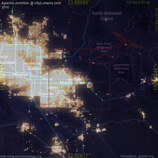
Analysis of Apache Junction night lights 2016
Square area 10x10 km:
 10.31%
90-99
12.41%80-89
6.82%70-79
8.39%60-69
15.56%50-59
11.01%40-49
9.97%30-39
9.79%20-29
7.69%10-19
7.52%0-9
0.52%Square area 50x50 km:
6.34%90-99
8.87%80-89
3.52%70-79
4.05%60-69
5.06%50-59
4.05%40-49
2.79%30-39
3.09%20-29
5.29%10-19
7.43%0-9
49.51%Clear (daylight) street map image can be seen on geolist.org.
Map coordinates:
33° 59' 59.9" North, 112° 15' 9.8" West
33° 24' 54.2" North, 111° 32' 58.5" West
32° 49' 34.2" North, 110° 50' 47.3" West
Some cities around Apache Junction sort by population:
• Mesa
25.4 km =15.8 mi,  271°
271°
• Chandler
29.7 km =18.5 mi,  245°
245°
• Gilbert
23.3 km =14.5 mi, 252°
• San Tan Valley
25 km =15.5 mi,  175°
175°
• Queen Creek
20.1 km =12.5 mi,  203°
203°
• Fountain Hills
26.8 km =16.7 mi,  324°
324°
• Gold Camp
26.5 km =16.5 mi,  120°
120°
• Gold Canyon
11.5 km =7.1 mi,  114°
114°
5551535 (p: 38,074)
Sources (retrieved 2019-11-25):
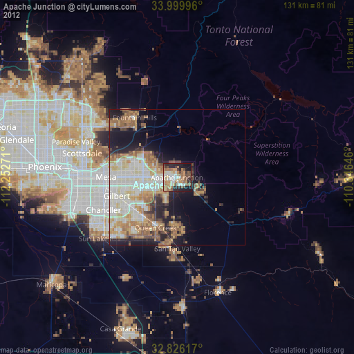
» Earth at Night: Flat Maps 2012, 2016