Forest Hill night lights from space
Night Light of Forest Hill (Texas) from space (United States) Src. Average luminocity for 10x10km area is 85.3357% and for 50x50km: 70.9352%.
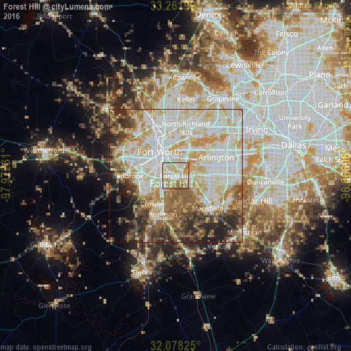
Analysis of Forest Hill night lights 2016
Square area 10x10 km:
 21.85%
90-99
23.25%80-89
21.5%70-79
15.91%60-69
14.51%50-59
2.97%40-49
0%30-39
0%20-29
0%10-19
0%0-9
0%Square area 50x50 km:
19.43%90-99
19.35%80-89
12.72%70-79
8.59%60-69
7.35%50-59
7.68%40-49
6.12%30-39
5.13%20-29
6.23%10-19
3.65%0-9
3.77%Clear (daylight) street map image can be seen on geolist.org.
Map coordinates:
33° 15' 43.2" North, 97° 58' 20.3" West
32° 40' 19.5" North, 97° 16' 9" West
32° 4' 41.7" North, 96° 33' 57.8" West
Some cities around Forest Hill sort by population:
• Fort Worth
7.7 km =4.8 mi,  320°
320°
• Haltom City
14.2 km =8.8 mi,  0°
0°
• Burleson
15.2 km =9.4 mi,  198°
198°
• Crowley
13.5 km =8.4 mi,  220°
220°
• Rendon
11 km =6.8 mi,  166°
166°
• Richland Hills
16.5 km =10.3 mi,  13°
13°
• Kennedale
4.9 km =3 mi,  124°
124°
• Everman
4.9 km =3 mi, 202°
4691766 (p: 12,881)
Sources (retrieved 2019-11-25):
» Earth at Night: Flat Maps 2012, 2016