Florence night lights from space
Night Light of Florence (Kentucky) from space (United States) Src. Average luminocity for 10x10km area is 85.6526% and for 50x50km: 39.7091%.

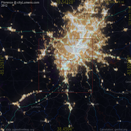
Analysis of Florence night lights 2016
Square area 10x10 km:
 27.11%
90-99
27.76%80-89
6.98%70-79
15.26%60-69
18.51%50-59
4.38%40-49
0%30-39
0%20-29
0%10-19
0%0-9
0%Square area 50x50 km:
8.18%90-99
8.21%80-89
5.5%70-79
7%60-69
7.55%50-59
5.75%40-49
3.2%30-39
3.3%20-29
4.79%10-19
9.28%0-9
37.24%Clear (daylight) street map image can be seen on geolist.org.
Map coordinates:
39° 32' 35.8" North, 85° 19' 47.1" West
38° 59' 56.2" North, 84° 37' 35.8" West
38° 27' 1.4" North, 83° 55' 24.6" West
Some cities around Florence sort by population:
• Independence
9.5 km =5.9 mi,  131°
131°
• Erlanger
3 km =1.9 mi,  48°
48°
• Burlington
9 km =5.6 mi,  290°
290°
• Oakbrook
5.1 km =3.2 mi,  271°
271°
• Edgewood
4.4 km =2.7 mi,  60°
60°
• Elsmere
2.4 km =1.5 mi, 51°
• Villa Hills
7.7 km =4.8 mi,  22°
22°
• Union
7.5 km =4.7 mi,  218°
218°
4291945 (p: 32,227)
Sources (retrieved 2019-11-25):
» Earth at Night: Flat Maps 2012, 2016