Union night lights from space
Night Light of Union (Kentucky) from space (United States) Src. Average luminocity for 10x10km area is 53.237% and for 50x50km: 30.9351%.
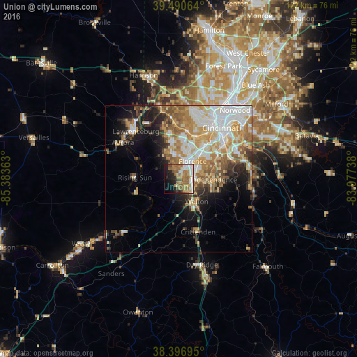
Analysis of Union night lights 2016
Square area 10x10 km:
 10.39%
90-99
10.39%80-89
3.25%70-79
10.39%60-69
14.29%50-59
9.9%40-49
4.71%30-39
0.97%20-29
10.88%10-19
15.26%0-9
9.58%Square area 50x50 km:
6.86%90-99
6.33%80-89
3.86%70-79
5.33%60-69
5.42%50-59
4.23%40-49
2.53%30-39
2.4%20-29
4.17%10-19
7.88%0-9
50.97%Clear (daylight) street map image can be seen on geolist.org.
Map coordinates:
39° 29' 26.3" North, 85° 23' 1.1" West
38° 56' 45.2" North, 84° 40' 49.8" West
38° 23' 49" North, 83° 58' 38.6" West
Some cities around Union sort by population:
• Florence
7.5 km =4.7 mi,  38°
38°
• Independence
11.8 km =7.3 mi,  91°
91°
• Erlanger
10.5 km =6.5 mi, 41°
• Burlington
9.8 km =6.1 mi,  337°
337°
• Oakbrook
6 km =3.7 mi,  356°
356°
• Edgewood
11.8 km =7.3 mi,  46°
46°
• Elsmere
9.9 km =6.2 mi, 41°
• Hebron
13.5 km =8.4 mi,  352°
352°
4311646 (p: 5,795)
Sources (retrieved 2019-11-25):
» Earth at Night: Flat Maps 2012, 2016