Burlington night lights from space
Night Light of Burlington (Kentucky) from space (United States) Src. Average luminocity for 10x10km area is 45.4984% and for 50x50km: 35.1156%.
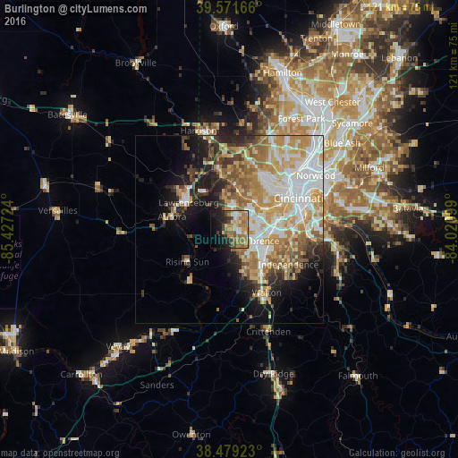
Analysis of Burlington night lights 2016
Square area 10x10 km:
 4.71%
4.71%90-99
8.12%80-89
3.08%70-79
7.79%60-69
17.21%50-59
7.47%40-49
6.82%30-39
2.6%20-29
9.58%10-19
16.88%0-9
15.75%Square area 50x50 km:
7.61%90-99
7.31%80-89
4.65%70-79
6.51%60-69
6.09%50-59
4.53%40-49
2.86%30-39
2.86%20-29
4.58%10-19
8.73%0-9
44.27%Clear (daylight) street map image can be seen on geolist.org.
Map coordinates:
39° 34' 18" North, 85° 25' 38.1" West
39° 1' 39.2" North, 84° 43' 26.8" West
38° 28' 45.2" North, 84° 1' 15.6" West
Some cities around Burlington sort by population:
• Florence
9 km =5.6 mi,  110°
110°
• Erlanger
10.7 km =6.6 mi,  96°
96°
• Oakbrook
4.6 km =2.9 mi,  132°
132°
• Elsmere
10.5 km =6.5 mi, 99°
• Francisville
8.6 km =5.3 mi,  359°
359°
• Hebron
4.7 km =2.9 mi,  25°
25°
• Union
9.8 km =6.1 mi,  157°
157°
• Delhi Hills
12 km =7.5 mi,  52°
52°
4286281 (p: 15,926)
Sources (retrieved 2019-11-25):
» Earth at Night: Flat Maps 2012, 2016