Fallsburg night lights from space
Night Light of Fallsburg (New York) from space (United States) Src. Average luminocity for 10x10km area is 18.2208% and for 50x50km: 3.4887%.
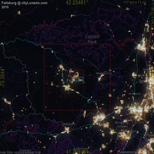
Analysis of Fallsburg night lights 2016
Square area 10x10 km:
 0.49%
0.49%90-99
0.32%80-89
1.62%70-79
2.76%60-69
3.73%50-59
4.06%40-49
7.31%30-39
3.41%20-29
3.41%10-19
9.58%0-9
63.31%Square area 50x50 km:
0.19%90-99
0.16%80-89
0.42%70-79
0.36%60-69
0.62%50-59
0.5%40-49
0.75%30-39
0.78%20-29
0.85%10-19
1.74%0-9
93.62%Clear (daylight) street map image can be seen on geolist.org.
Map coordinates:
42° 15' 16.6" North, 75° 18' 15.8" West
41° 43' 55.3" North, 74° 36' 4.6" West
41° 12' 18.6" North, 73° 53' 53.3" West
Some cities around Fallsburg sort by population:
• Middletown
35.1 km =21.8 mi,  155°
155°
• Wawarsing
20.5 km =12.7 mi,  81°
81°
• Scotchtown
34.3 km =21.3 mi,  144°
144°
• Port Jervis
40.4 km =25.1 mi,  190°
190°
• New Paltz
42.7 km =26.5 mi,  87°
87°
• Mechanicstown
36.7 km =22.8 mi,  151°
151°
• Walden
39.2 km =24.4 mi,  118°
118°
• Monticello
11.2 km =7 mi,  220°
220°
5116900 (p: 12,773)
Sources (retrieved 2019-11-25):
» Earth at Night: Flat Maps 2012, 2016