Enumclaw night lights from space
Night Light of Enumclaw (Washington) from space (United States) Src. Average luminocity for 10x10km area is 12.6235% and for 50x50km: 17.6442%.
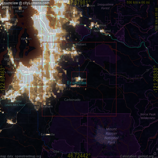
Analysis of Enumclaw night lights 2016
Square area 10x10 km:
 0.74%
0.74%90-99
1.64%80-89
1.04%70-79
1.79%60-69
2.68%50-59
1.34%40-49
2.83%30-39
1.79%20-29
1.49%10-19
4.61%0-9
80.06%Square area 50x50 km:
3.12%90-99
3.56%80-89
1.69%70-79
2.85%60-69
3.52%50-59
2.96%40-49
2.31%30-39
2.25%20-29
2.84%10-19
4.59%0-9
70.3%Clear (daylight) street map image can be seen on geolist.org.
Map coordinates:
47° 40' 47.3" North, 122° 41' 40.7" West
47° 12' 15.4" North, 121° 59' 29.4" West
46° 43' 27.9" North, 121° 17' 18.2" West
Some cities around Enumclaw sort by population:
• Bonney Lake
15 km =9.3 mi,  258°
258°
• Covington
19.7 km =12.2 mi,  330°
330°
• Lea Hill
19.7 km =12.2 mi,  313°
313°
• Prairie Ridge
14 km =8.7 mi,  238°
238°
• Lake Morton-Berrydale
16.6 km =10.3 mi, 329°
• Sumner
18.8 km =11.7 mi,  269°
269°
• Orting
20 km =12.4 mi,  233°
233°
• Pacific
20.6 km =12.8 mi,  288°
288°
5793822 (p: 11,609)
Sources (retrieved 2019-11-25):
» Earth at Night: Flat Maps 2012, 2016