Ellsworth night lights from space
Night Light of Ellsworth (Maine) from space (United States) Src. Average luminocity for 10x10km area is 12.3476% and for 50x50km: 0.8032%.
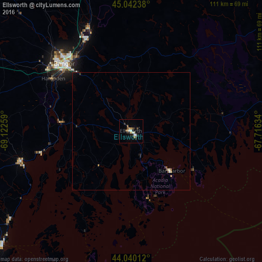
Analysis of Ellsworth night lights 2016
Square area 10x10 km:
 1.75%
1.75%90-99
1.9%80-89
0.79%70-79
2.06%60-69
1.11%50-59
2.06%40-49
1.11%30-39
1.75%20-29
3.33%10-19
2.38%0-9
81.75%Square area 50x50 km:
0.07%90-99
0.14%80-89
0.09%70-79
0.1%60-69
0.04%50-59
0.13%40-49
0.09%30-39
0.17%20-29
0.18%10-19
0.2%0-9
98.79%Clear (daylight) street map image can be seen on geolist.org.
Map coordinates:
45° 2' 32.6" North, 69° 7' 21.3" West
44° 32' 36.3" North, 68° 25' 10.1" West
44° 2' 24.4" North, 67° 42' 58.8" West
Some cities around Ellsworth sort by population:
• Bangor
40.3 km =25 mi,  315°
315°
• Waterville
96.1 km =59.7 mi,  270°
270°
• Orono
42.7 km =26.5 mi,  332°
332°
• Brewer
39 km =24.2 mi, 316°
• Winslow
95.2 km =59.2 mi, 270°
• Old Town
47 km =29.2 mi,  337°
337°
• Rockland
73.5 km =45.7 mi,  228°
228°
• Belfast
48.4 km =30.1 mi,  254°
254°
4963692 (p: 7,857)
Sources (retrieved 2019-11-25):
» Earth at Night: Flat Maps 2012, 2016