Elk Plain night lights from space
Night Light of Elk Plain (Washington) from space (United States) Src. Average luminocity for 10x10km area is 30.4659% and for 50x50km: 24.2485%.
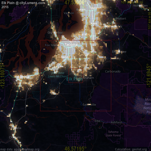
Analysis of Elk Plain night lights 2016
Square area 10x10 km:
 2.7%
2.7%90-99
3.13%80-89
1.7%70-79
3.69%60-69
6.82%50-59
5.82%40-49
7.95%30-39
6.53%20-29
13.49%10-19
18.89%0-9
29.26%Square area 50x50 km:
5.94%90-99
4.65%80-89
1.72%70-79
2.75%60-69
4.34%50-59
5.15%40-49
3.11%30-39
2.31%20-29
3.74%10-19
6.67%0-9
59.61%Clear (daylight) street map image can be seen on geolist.org.
Map coordinates:
47° 31' 48.2" North, 123° 6' 2.7" West
47° 3' 11.4" North, 122° 23' 51.4" West
46° 34' 19" North, 121° 41' 40.2" West
Some cities around Elk Plain sort by population:
• South Hill
13.7 km =8.5 mi,  44°
44°
• Parkland
11.7 km =7.3 mi,  346°
346°
• Spanaway
6.3 km =3.9 mi,  333°
333°
• Graham
7.8 km =4.8 mi,  90°
90°
• Frederickson
5.6 km =3.5 mi,  31°
31°
• Midland
12.7 km =7.9 mi,  357°
357°
• Summit
12.5 km =7.8 mi,  14°
14°
• Summit View
9.9 km =6.2 mi,  20°
20°
5793609 (p: 14,205)
Sources (retrieved 2019-11-25):
» Earth at Night: Flat Maps 2012, 2016