Deltona night lights from space
Night Light of Deltona (Florida) from space (United States) Src. Average luminocity for 10x10km area is 68.6607% and for 50x50km: 27.7668%.
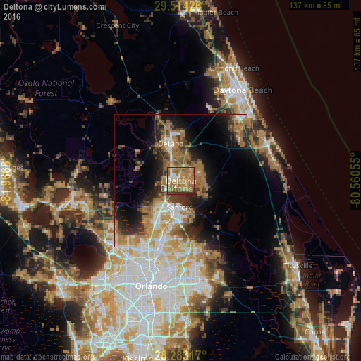
Analysis of Deltona night lights 2016
Square area 10x10 km:
 6.75%
6.75%90-99
9.33%80-89
7.34%70-79
12.7%60-69
41.67%50-59
12.7%40-49
0.79%30-39
8.73%20-29
0%10-19
0%0-9
0%Square area 50x50 km:
3.28%90-99
4.18%80-89
2.28%70-79
4.18%60-69
9.84%50-59
4.21%40-49
3.33%30-39
4.61%20-29
5.72%10-19
10.29%0-9
48.09%Clear (daylight) street map image can be seen on geolist.org.
Map coordinates:
29° 30' 51.3" North, 81° 58' 0.5" West
28° 54' 1.9" North, 81° 15' 49.2" West
28° 16' 59.4" North, 80° 33' 38" West
Some cities around Deltona sort by population:
• Sanford
11.2 km =7 mi,  184°
184°
• Winter Springs
22.8 km =14.2 mi,  190°
190°
• DeLand
14.7 km =9.1 mi,  344°
344°
• DeBary
4.8 km =3 mi,  246°
246°
• Lake Mary
16.6 km =10.3 mi,  198°
198°
• Longwood
23.1 km =14.4 mi, 198°
• Orange City
6.4 km =4 mi,  327°
327°
• Heathrow
18.6 km =11.6 mi,  214°
214°
4153146 (p: 88,474)
Sources (retrieved 2019-11-25):
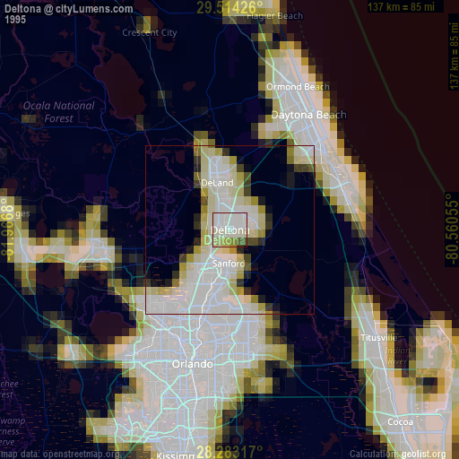
» NASA, Earths city lights 1995
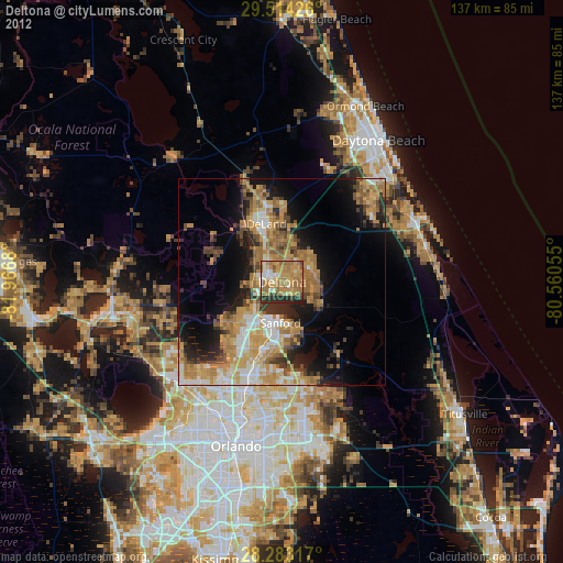
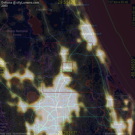
» NASA city lights 2003
» Earth at Night: Flat Maps 2012, 2016