DeLand night lights from space
Night Light of DeLand (Florida) from space (United States) Src. Average luminocity for 10x10km area is 64.5714% and for 50x50km: 19.4272%.
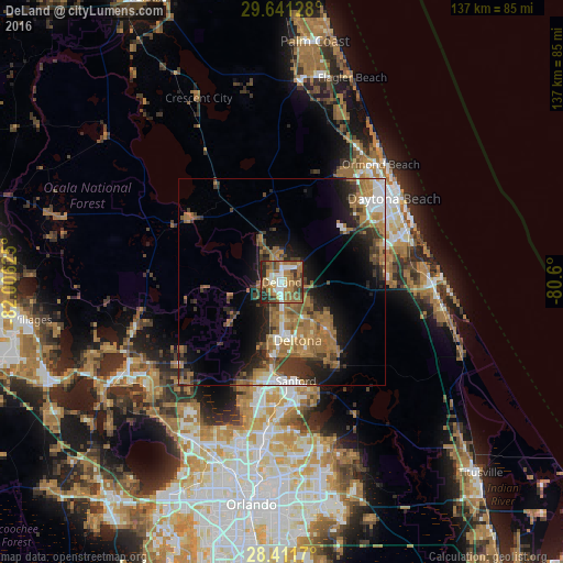
Analysis of DeLand night lights 2016
Square area 10x10 km:
 9.13%
9.13%90-99
13.29%80-89
2.98%70-79
7.34%60-69
31.15%50-59
10.91%40-49
10.52%30-39
5.75%20-29
8.93%10-19
0%0-9
0%Square area 50x50 km:
1.96%90-99
2.25%80-89
0.83%70-79
1.53%60-69
8.46%50-59
3.62%40-49
2.88%30-39
4.33%20-29
4.81%10-19
8.45%0-9
60.89%Clear (daylight) street map image can be seen on geolist.org.
Map coordinates:
29° 38' 28.6" North, 82° 0' 22.5" West
29° 1' 42" North, 81° 18' 11.2" West
28° 24' 42.1" North, 80° 36' 0" West
Some cities around DeLand sort by population:
• Deltona
14.7 km =9.1 mi,  164°
164°
• Port Orange
32.3 km =20.1 mi,  67°
67°
• Sanford
25.5 km =15.8 mi,  173°
173°
• DeBary
16.2 km =10.1 mi,  181°
181°
• Lake Mary
30 km =18.6 mi, 182°
• Orange City
8.8 km =5.5 mi, 177°
• Heathrow
30.2 km =18.8 mi,  192°
192°
• Samsula-Spruce Creek
23.6 km =14.7 mi,  84°
84°
4152890 (p: 30,195)
Sources (retrieved 2019-11-25):
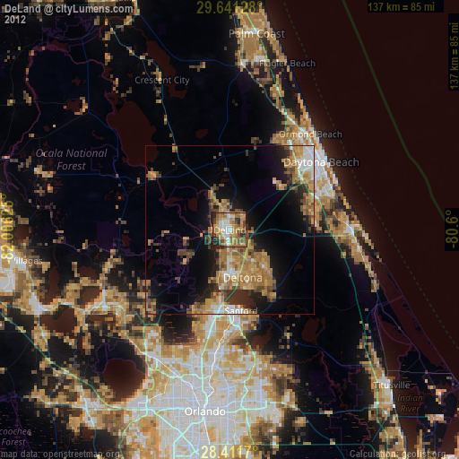
» Earth at Night: Flat Maps 2012, 2016