Port Orange night lights from space
Night Light of Port Orange (Florida) from space (United States) Src. Average luminocity for 10x10km area is 70.0337% and for 50x50km: 19.3919%.
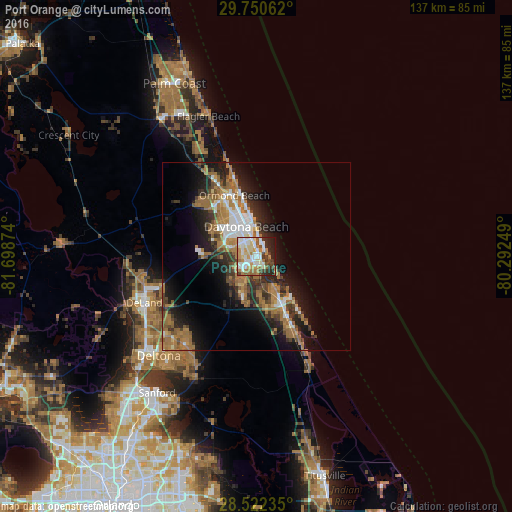
Analysis of Port Orange night lights 2016
Square area 10x10 km:
 13.89%
90-99
21.43%80-89
11.31%70-79
8.93%60-69
13.1%50-59
4.56%40-49
7.54%30-39
5.16%20-29
9.92%10-19
4.17%0-9
0%Square area 50x50 km:
2.6%90-99
2.9%80-89
1.17%70-79
1.78%60-69
7.35%50-59
2.31%40-49
2.63%30-39
3.15%20-29
5.13%10-19
10.13%0-9
60.85%Clear (daylight) street map image can be seen on geolist.org.
Map coordinates:
29° 45' 2.2" North, 81° 41' 55.5" West
29° 8' 18" North, 80° 59' 44.2" West
28° 31' 20.5" North, 80° 17' 33" West
Some cities around Port Orange sort by population:
• Daytona Beach
8.5 km =5.3 mi,  341°
341°
• Ormond Beach
17.4 km =10.8 mi, 340°
• New Smyrna Beach
14.2 km =8.8 mi,  151°
151°
• Edgewater
18.9 km =11.7 mi, 151°
• South Daytona
3.2 km =2 mi, 344°
• Holly Hill
12.4 km =7.7 mi, 340°
• Ormond-by-the-Sea
24.4 km =15.2 mi, 343°
• Samsula-Spruce Creek
11.8 km =7.3 mi,  213°
213°
4169156 (p: 59,866)
Sources (retrieved 2019-11-25):
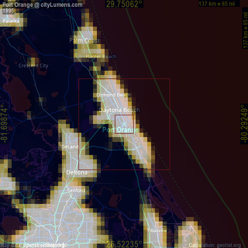
» NASA, Earths city lights 1995
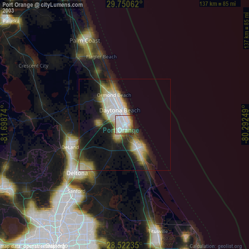
» NASA city lights 2003
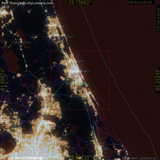
» Earth at Night: Flat Maps 2012, 2016